Menu Close

Cayuse

Sailing triplets

Reef Passages

The second longest barrier reef in the world extends from Cancun south along the east coast of Mexico and Belize to almost Guatemala. We are sailing south along the outside or Caribbean Sea part of the reef. To stop or anchor in a bay, we have to pass through an opening in the reef. Most of the bays have a place on the reef were it is not continuous and is free of coral heads. Sometimes this pass is a half a mile wide and in other places it is only 300 feet wide. The trade winds here blow continuously from the east at between 15 and 25 knots and the waves also move from east to west (with wave heights between 4 to 12 feet). All of this means that you approach the passages with the wind and big waves behind you moving very fast. You usually have to commit and do not get a second go at it. You should do it during the day between 10 and 2 so that you can see the waves breaking on the reef and the coral in the water. After we left Puerto Aventuras headed towards Belize, the weather became very squally with heavy rain and strong downpours and wind in the squalls. We decided to sail into and anchor behind the reef in Bahia del Espiritu Santo to wait on the weather to improve. On the morning we were planning to leave, we were listening to the radio net (on our high frequency or long range radio) for the northwest Caribbean. They were reporting that a sailboat had gone up on the reef (trying to enter late in the day in squally weather) the evening before in the bay north of us. Both bays are mostly uninhabited and part of a huge Mexican biosphere park. Looking at the charts, it appeared that we were only about 20 miles from his reported position so we volunteered to try and raise the Mexican navy or someone else on our VHF or short range radio. We were able to raise the Casablanca bone fishing lodge in Bahia de la Ascension. They dispatched one of their bone fishing boats with a guide and a contingent of Mexican soldiers from a local outpost. They located the boat on the reef and found the sailor (he was single handing) who had boarded his life raft. It turned out he was fine and the Mexican marines took him to Cozumel (probably to fine him for damaging the reef). We spent most of the morning communicating between net control (in Honduras) on our SSB radio and the fishing lodge on our VHF radio. The boat remains partially submerged on the reef.

Yucatan 051Yucatan 055

Cameron the Rigger

We needed some work done on our mast. The choice was to haul me (195 lbs) up or one of the kids. Cameron (80 lbs) volunteered. Here he is more than 2/3’s of the way up the mast (55 feet or so).

Yucatan 046

Mayan Redux

With some time on our hands while waiting on the weather to improve a bit, we visited some more Mayan sites, Coba and Tulum. Coba is about 30 miles inland from the Caribbean coast and is the largest pre-Hispanic site in the Yucatan. The Coba site consists of 4 separate groups of buildings (Coba group, D group, Nohoch Mul group, and Macanxoc group) that are spread out over a very large site. It is more than a mile between each group of buildings. You can either walk or ride a bike to the different groups. The buildings were built around two large lakes which were the Mayans’ source of fresh water. The Coba site is largely unrestored, with small gravel trails cut through the jungle between the sites. Many of the buildings are still covered by dense foliage. Cameron, Haley, and Travis enjoyed Coba because the Nohoch Mul group includes the Nohoch Mul which is the tallest structure in the Mayan Yucatan. It is an asymmetrical pyramid structure about 140 feet tall with a staircase on one side leading to a vaulted room on top. (The Castle [the pyramid] at Chichen Itza is symmetrical with stairs on 4 sides.) Unlike the pyramid at Chichen Itza, they still permit you to climb to the top of the pyramid at Coba, which we did. Nohoch Mul means “big mound” in Mayan, which it certainly is. It is easy to see why the Mayans liked building pyramids because you can see for miles over the jungle from the top. The Coba site also includes some great examples of the roads the Mayans built, which are called Sacbe. There are over 50 roads from Coba. The longest one continues for 62 miles to almost Chichen Itza and is 30 inches high and 32 feet wide. The Sacbe were constructed with two vertical walls of large stones, with the interior filled with smaller stones and dirt and then topped with a stucco substance. After seeing Coba, we drove back to Tulum which is the large Mayan site on the coast. (There are small Mayan sites everywhere. There is a small Mayan building about 500 yards from where we are now.) The temple at Tulum is built on a bluff facing the Caribbean. Tulum was used by the Mayans as a port to move goods up and down the Mayan coast. The ruins at Tulum are completely excavated and in some cases partially restored.

Yucatan 034 Yucatan 041

School Daze

Boat school occurs most days when we are not sailing or seeing the sights. It usually last about 4 hours and the subjects consist of math, English, and introductory Spanish. They are taking 7th grade math and English. Some days are better than others. Cameron, Haley, and Travis also read much more on the boat than they would at home because there are fewer distractions (no Play Station, TV, or computer).

Main cenote

Main cenote

Saving Money the Hard Way

Cameron, Haley, and Travis saw an advertisement for a water park in a natural inlet on the coast near the town of Tulum, called Xel-Ha. While walking through town, we saw a tour business offering tickets to Xel-Ha so we stopped in to ask about prices. The retail price was about $300 plus the cost of the cab (another $100). This seemed a little out of our cruising budget so we started to leave. The tour guy then said that if we were willing to stop at a timeshare development called the Mayan Palace on the way over for a 90 minute presentation (which included a free, complete breakfast), they would pick up all our costs including transportation costs, except for $100. Not having been to a timeshare presentation before, this did not seem too high a price to pay to get about $300 of our costs covered to go to the water park. So we agreed to go. On the designated day, they picked us up in a van and drove us to the Mayan Resorts condominium development near Playa del Carmen. Among other things, it boasts the largest swimming pool in Latin America (which we only walked by). We met our appointed sales agent, a young Australian guy. The presentation started off gently with a mild grilling about our intentions trying to determine, I believe, our ability and desire to purchase one of their units and to see if we were regulars on the timeshare circuit looking for freebies. We were certainly looking for the freebies, but were not regulars so we passed the initial test. We then were treated to a very nice free breakfast before they showed us the development. It is a huge real estate development right on the Mayan coast with what looked like thousands of units, a nice beach, golf course, and the big pool. Sort of like a big cruise ship on land. After the tour, we were taken to the sales room. That is when the hard sell began. The first guy tried to get us to commit $130,000 on the spot to purchase 12 weeks a year by trying to rationalize its value to us over the next 20 years. When we balked, he promptly dropped to about $65,000 for few less weeks. When we declined that offer, another guy showed up and pretended to be angry at us by alleging that we had never intended to buy a timeshare (true) and hoping to guilt us into buying one. The entire sales pitch was made without any printed material. They refused to even give us a brochure. They wanted us to drop that kind of money based entirely on a 90 minute presentation and some guy writing quickly and drawing boxes with a flair pen on a piece of paper. Well, to make a long story short, by the time we made it to the fourth and last sales guy the price was down to $6500, which was offered in a beg and plead approach. 90 minutes had quickly turned into 3 hours, but we were finally able to leave with our free tickets. We made it to the water park (which was nice), but we had given up much of the day at the presentation. The morals of this timeshare story are that if you are considering a timeshare never take the first offer and the freebies are never worth the pain and suffering you are going to endure.

Yucatan 022

Apocalypto

The Mayans ruled the Yucatan (and Guatemala and Honduras) for more than a 1000 years. Literally hundreds of Mayan sites are scattered around the area from the very small temple at Punta Sur on Isla Mujeres to the large Mayan cities at Chichen Itza, Uxmal, and Tikal. The Mayans were very advanced, including a written language, inventing the concept of zero in math, creating a calendar (with the first year beginning in 3313 B.C. for some reason), and learning the phases of the moon, when eclipses would occur, and the movements of Venus, Mars, and Jupiter. They also were very religious and worshiped many gods (the concept of one God had not caught on). One of their common religious rites was human sacrifices. Children were sacrificed to the God of Chac (or god of thunder and rain). The face of the victim was painted blue and his or her heart was torn out at the sacrifice site. The religious faithful then dined on the corpse of the victim or they pitched the mutilated body into a cenote or some other sacred body of water. When we were touring the site at Chichen Itza, this caught Cameron, Haley, and Travis’ attention, but otherwise they have really enjoyed seeing the Mayan sites.

IMG_0033

Rainy Isla Mujeres

Well, about the time we were ready to depart, El Nino started impacting winter weather conditions in the southeast U.S. and the Gulf of Mexico, including the first ice storm in 10 years. So our departure and Gulf crossing was delayed a couple of weeks, but we finally thought we saw a reasonable weather window to cross the Gulf to Isla Mujeres. It can be a challenging crossing because the rhumb line course is directly into the prevailing southeast breeze. Our strategy was to use a frontal passage to back the wind around to the north for as long as possible. We cleared the Galveston jetties on a Saturday at 1:30 a.m. in morning arriving in Isla Mujeres 109 hours later on Wednesday at 2:30 p.m. in the afternoon. We had very nice sailing conditions for the first two days of the trip and made 380 miles in the first 48 hours. For the first 100 miles or so after leaving, we passed through and dodged the minefield of oil and gas rigs and commercial tankers off Galveston, but after that we did not see another ship until we reached the Yucatan. The last two days of the trip were quite rough. We were north and west of the Yucatan peninsula and the winds built to about 30 knots from the east northeast (the direction we needed to go) and the seas increased to 10 to 13 feet. We had slow, lumpy, and very wet conditions for 2 days. But we arrived in Isla Mujeres mostly intact and with no major damage to the boat. We then spent the next couple of days recovering, cleaning up the boat, and clearing Mexican customs and immigration, which is a very formal and time consuming process. We are going to spend a few days seeing Isla Mujeres and the Yucatan and then determine where we are headed next.

Happy New Year

Happy New Year 2007.  Cameron, Haley, and Travis have just finished the first semester of sixth grade, which is the first year of middle school. We have decided to take off cruising again heading first to Mexico and then on to Central America.

Heading north

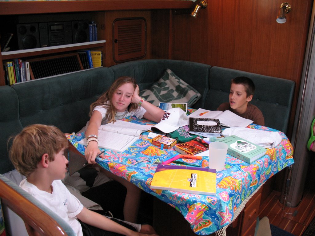
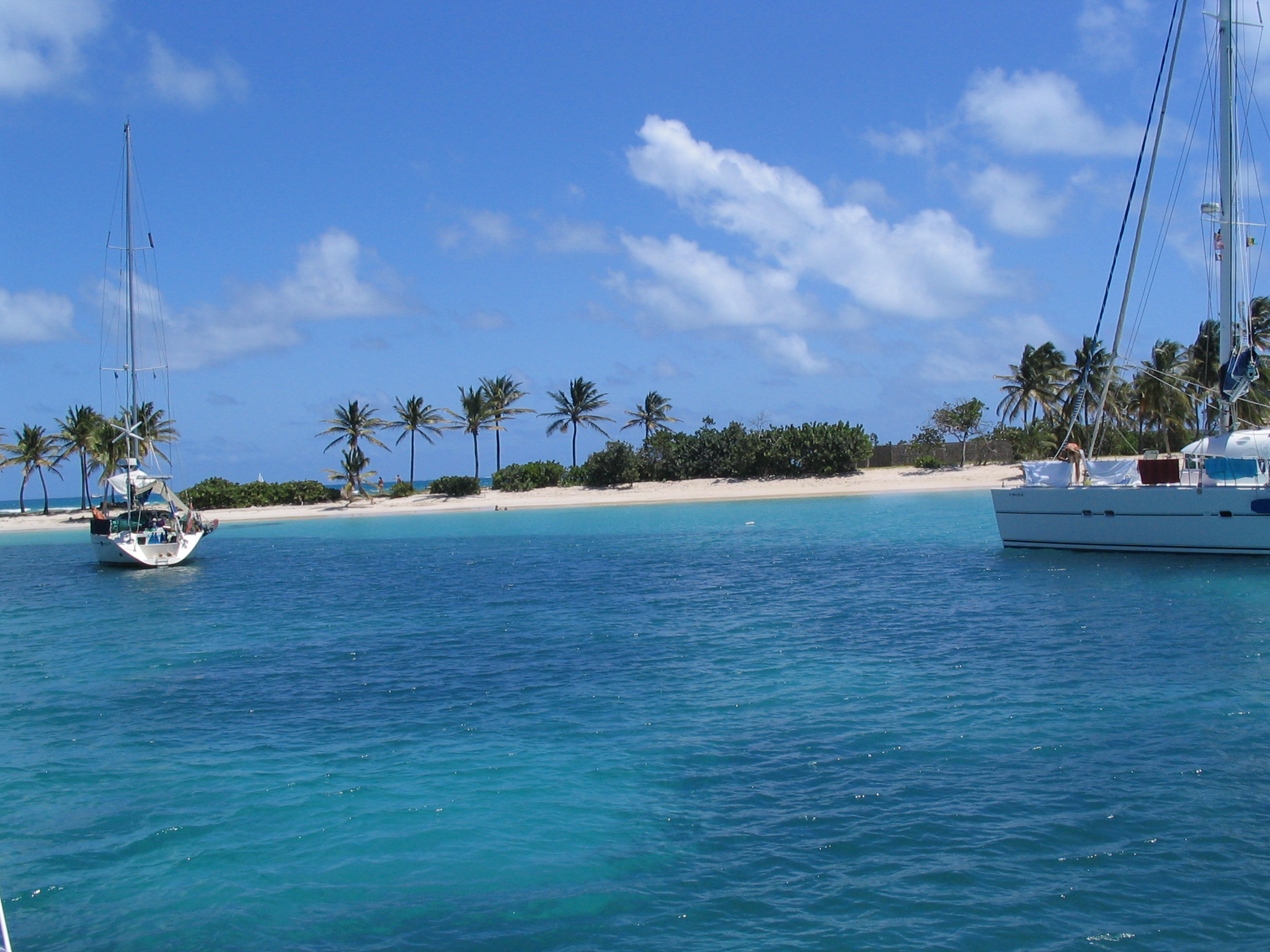
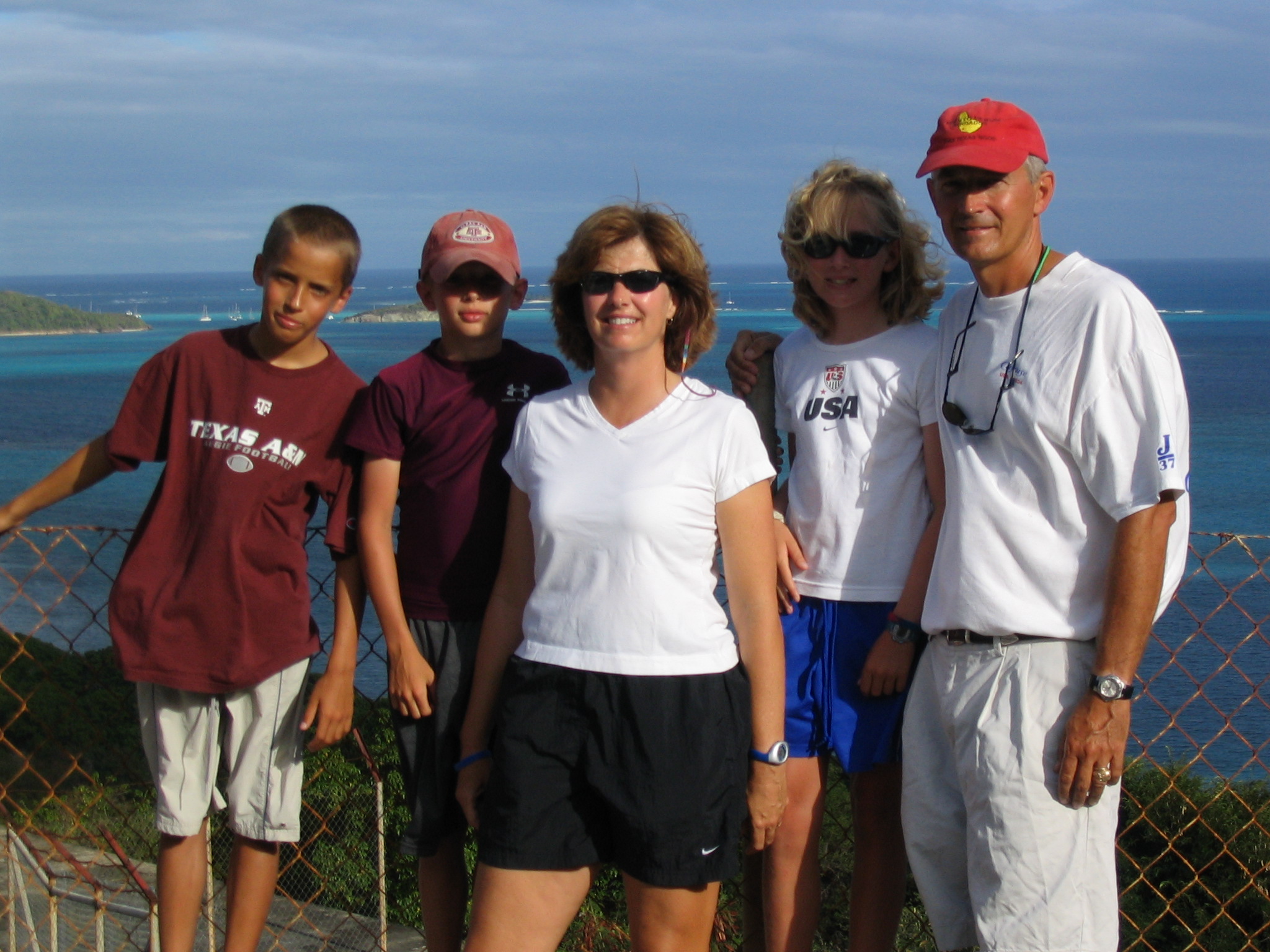
We sailed back to Bequia from Union Island to pick up Austin Espey, a friend of Travis and Cameron, who flew down for Spring Break. The day after he arrived we took the ferry from Bequia over to St. Vincent and drove up to the north end of St. Vincent and then hiked up to Trinity Falls. A very strenuous hike which at times was so steep that we had to use ladders. We ate lunch and swam at the falls. IMG_0249The north end of St. Vincent is very tropical (similar to Dominica) and not very densely populated. Most of the St. Vincent Rasta men live on the side of Mt. Soufriere in this part of the island. On the way to the falls we passed through Wallilabou, where filming of Pirates of the Caribbean II and III was about to begin. Both films will be shot at the same time. After returning to Bequia, we headed back down island for a week in the Grenadines. Our first stop was back to Chatham Bay on Union Island, which was one of our favorite anchorages in the Grenadines (and the Caribbean). A very large protected bay with beautiful coral, a huge white beach, and lots of fish. It is not developed and a little off the beaten path so typically there are only few boats there. After a couple of days, we headed back to the Tobago Cays. IMG_0259We ended up in a great spot off of Petit Bateau. Interestingly we had a couple of boats next to us that had sailed down from Norfolk in the rally in November. The number of boats from the U.S. cruising full time in the Caribbean is relatively small and we saw the same boats in many of the anchorages. After the Tobago Cays, we sailed up to Canouan and spent the night there. Entering the harbor we sailed into the strongest squall we have experienced yet while in the Caribbean. The wind gusted to 30 knots, driving rain, and no visibility. Fortunately, it did not last long. After a night in Canouan, we sailed back to Bequia where Austin headed back to Texas. While Austin was with us, we were probably the only small boat in the Eastern Caribbean with 4 ten-year old kids on board.

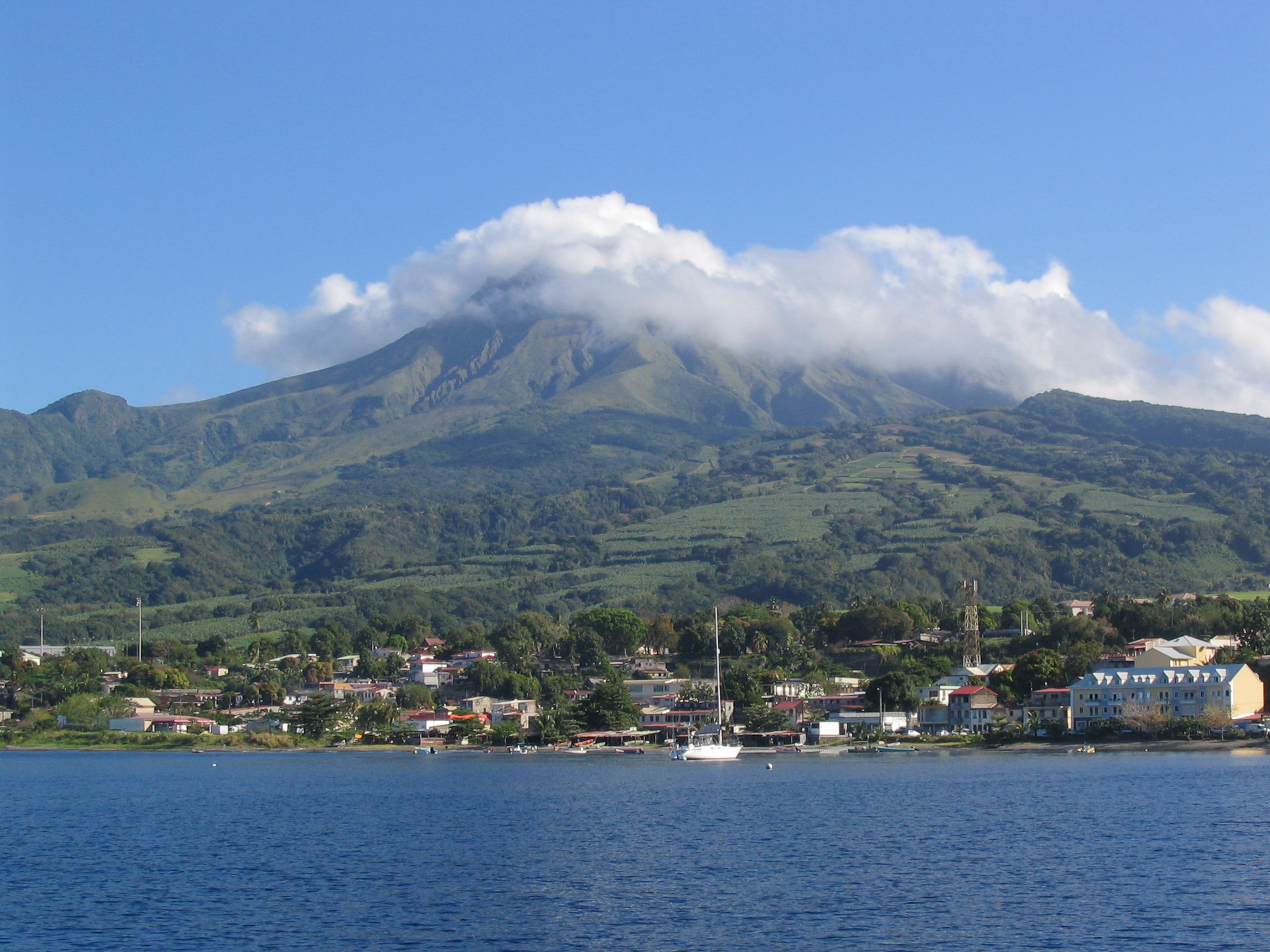
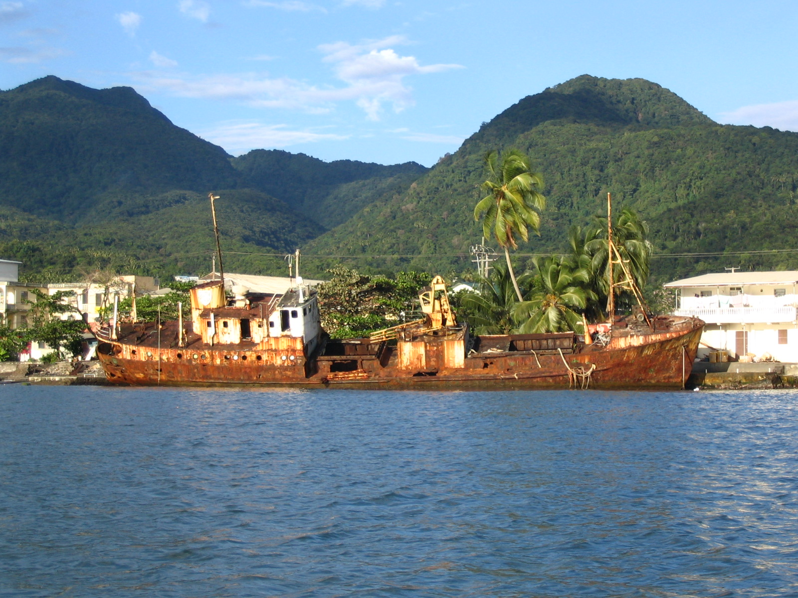
The morning after Austin left, we started our trek back to the north. We left Bequia at 5:00 a.m. and sailed up the west side of St. Vincent to Rodney Bay, St. Lucia, about 80 miles. A very long day. Rodney Bay Marina is where the ARC (Atlantic Rally for Cruisers) finishes each year so there are lots of European boats in the marina and in the area. After a couple of days in Rodney Bay working on the boat, we sailed up to St. Pierre on the French island of Martinique. St. Pierre is a small town with a long history at the base of Mt. Pele on the north end of the island. After anchoring off the town dock, we spent a couple of hours at the local museum. St. Pierre was established in the 1600’s and by the late 1800’s was known as the Paris of the Caribbean with over 30,000 residents. But, on May 8, 1902, Mt. Pele intervened. It erupted and destroyed the entire town, including most of the ships anchored in the harbor. The side of the volcano facing the town collapsed releasing a fireball of superheated gas that rolled down and burned the entire town killing all of the residents except one. The only survivor (a man named Cyparis) was locked up for murder in the solitary confinement cell in the basement of the local prison. Although he survived, he was burned badly. After recovering, he spent the next 20 years or so as a side show act in the Barnum and Bailey circus touring the U.S. Many of the ruins still remain in the town. We toured the local theater that was built in the late 1600’s. The town now has only about 6000 residents and Mt. Pele is considered dormant.

IMG_0276

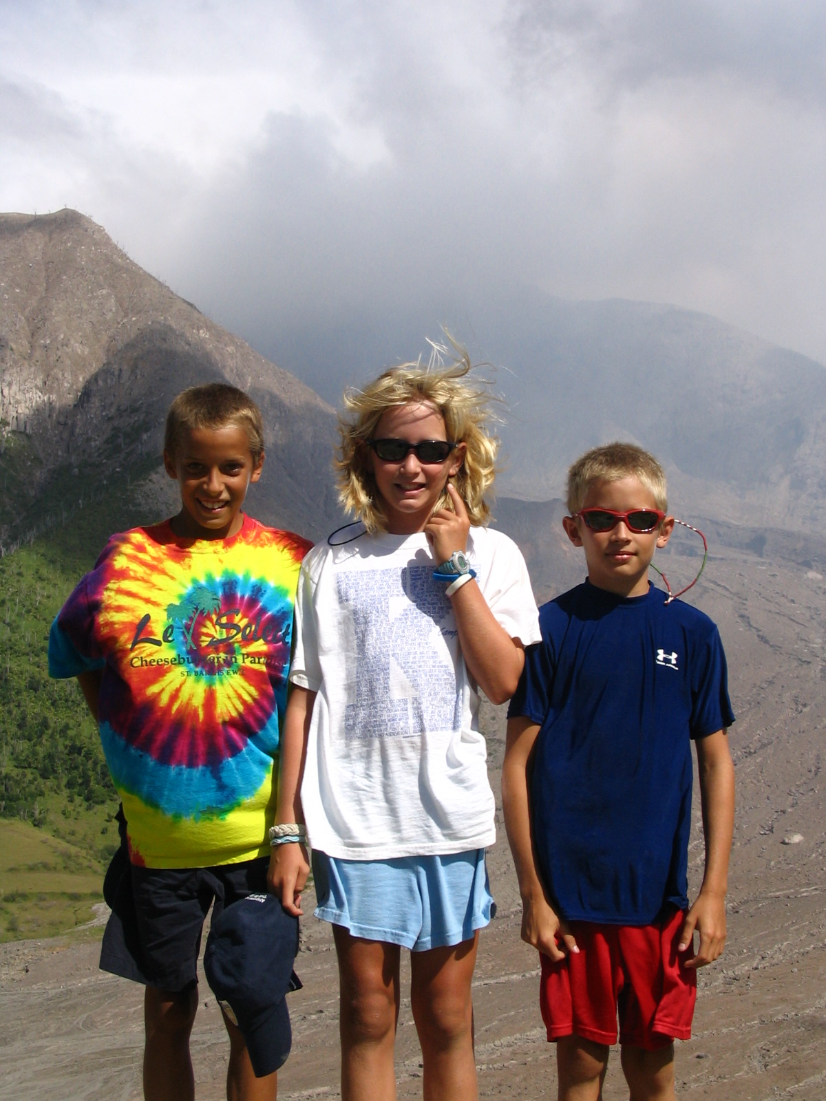
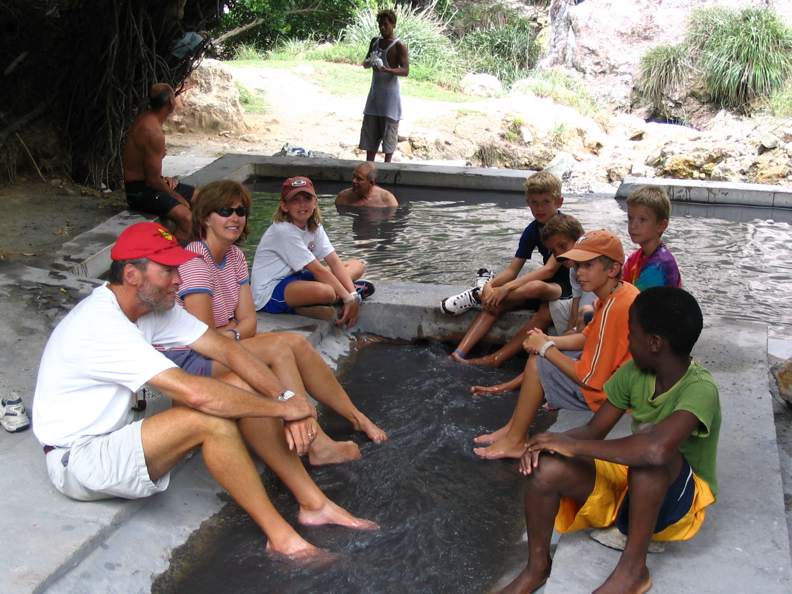
After leaving St. Pierre, we sailed up to the town of Roseau which is the capital of Dominica. There were only a couple of boats anchored off the town. Dominica is a place where it is customary to hire a “boat boy” when you stop (and a good idea; a sailboat anchored near us that failed to hire a boat boy was robbed while they slept when we were in Roseau). He helps with customs, arranges tours, and otherwise helps you get around the country while you are there for a fairly small amount. We hired a guy named Pancho. The first day there we took a tour with Pancho up to Victoria Falls on the east side of the island. We drove up into the mountains to the river downstream of the falls. We then hiked up a flowing river bed, crossing the river 5 times, to get up to the falls. There was no trail and we had a very steep hike climbing over huge boulders. At the base of the waterfall there was a large pool where we tried to swim, but it was difficult. The water is very cold and the falling water generates a very strong breeze and blowing spray. After hiking down, we ate lunch with a Rasta man named Moses. He lives with his family along the river in a small corrugated tin structure with no running water or electricity. He cooked us a stew that was made from Calulu, Daphene, and other roots grown near his house. He also made a salad out of a vegetable that looked a lot like spinach (but we were unsure what it was). The bowls and spoons he used where made from coconut shells. The kids loved it.

IMG_0289

After lunch, we drove over to the Emerald Pool, a tropical rain forest in a U.N. World Heritage Site, and swam. Dominica was one of our favorite islands to visit. After a couple of days in Dominica, we headed up to the Iles de Saintes.

IMG_0287 (2)

We sailed up from Dominica on a day when the trades were blowing vigorously. We had winds from the east at 20 to 30 knots and 8 to 10 foot seas. The boat loves those conditions and we were reaching along at around 9 knots. Because the easterly trades where blowing steadily, we elected to head to the island of Terre D’en Haut and anchor off the town of Bourg de Saintes which provided good protection from the east. It is very hard not to like the small towns on the French islands. Great restaurants and stores, beautiful beaches, and nice people. We spent 4 days in Bourg de Saintes hanging out on the beaches and eating in the bakeries and restaurants. Because of the current weakness of the dollar against the euro, the French islands can be a bit expensive. (Most of the other islands use either the dollar or a currency that has a fixed exchange rate against the dollar.) The next island north is another French island, Guadeloupe. We headed up the west side of Guadeloupe and stopped at Pigeon Island, a Cousteau Underwater Park. We snorkeled around the island and had great visibility in the water, in excess of 150 feet. We then headed up to Deshaies, the northern most harbor on the western side of Guadalupe and a good jumping off point for a long sail up to Antigua. The next day when we were departing for Antigua at about 6:00 a.m the windlass stopped working and we had to finish pulling up the anchor and rode by hand. The windlass is an electric device that is used to let down and pull up the anchor. Our anchor weighs 80 pounds and the chain attached to it weighs about 2 pounds per foot. We usually let out about 100 feet of rode when anchoring so having a working windlass is critical. Without a functioning windlass anchoring is difficult so we headed to Jolly Harbor, a marina on the west side of Antigua where there are several marine stores.

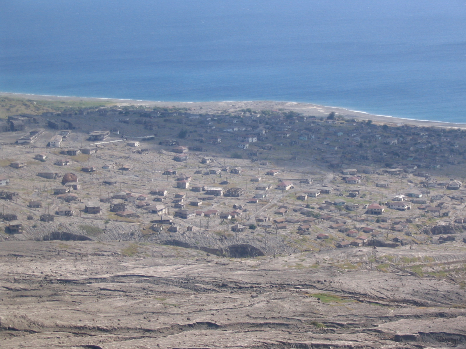
The day after arriving we spent about 12 hours removing the windlass from the bow (it weighs about 80 pounds and, as with most things on boats, is located in an awkward spot) and disassembling it to identify the problem. The electric motor was shot. We installed a new electric motor and rebuilt the gearbox and it is now working like new. Also, while in Antigua, we really wanted to see Montserrat, which is an island in the Leewards with an active volcano, but it is very difficult to take your boat there because much of the island is off limits. So instead we took a ferry from St. John, Antigua for day trip over to Montserrat. In 1995 Montserrat was a thriving part of the British West Indies, with about 12,000 residents. That year the Soufriere Hills volcano began erupting. The pyroclastic flow (ash, rocks, and mud) from the volcano has covered and destroyed the capital of Plymouth and the airport and many houses and hotels on the island. IMG_0307The volcano has continued to erupt with varying levels of intensity. In response to the initial series of eruptions, the British government tried to incent the Montserratians to move to London. They were hoping to remove everyone from the island and close it. They offered monetary rewards to families to resettle in London. Many folks left but about 4000 stayed and moved to the northern tip of the island, which was relatively free from the effects of the eruption. The southern part of the island is called the Exclusion Zone. We took a tour of the Exclusion Zone with a local guy whose house was covered by ash and lava. Everything in the Exclusion Zone looks like it did before the eruptions began. The buildings remain mostly undisturbed except that they are partially filled with mud and ash from the pyroclastic flow. IMG_0300We also toured the Montserrat Volcano Observatory which was built by the British to monitor seismic activity around the volcano to provide an early warning of future eruptions. We met with several of the vulcanoligists and seismologists working that day.

The day after we returned from Montserrat, we left the marina and headed to the Boon Channel on the north side of Antigua and anchored in Jumby Bay. A very pretty anchorage with very fine white sand. The anchorage is exposed to the north and there was a big north ground swell running, but we were behind a reef and the water was very flat. The north ground swell has affected our sailing and anchoring the whole trip and was not something we had anticipated. When fronts move off the U.S. east coast, they usually track east and northeastward near Bermuda. The fronts never make it to the Caribbean but the low associated with the front creates waves that make it all the way down into the southern Caribbean. Because the trade winds blow from the east most of the anchorages are on the western shores of the islands. But when a big north swell is running, it can roll right into the western anchorages and make them uncomfortable and sometimes untenable.

After a few days on the north side of Antigua, it was time to continue north, which meant a very long sail on a light air day to St. Barth. The sail was very uneventful until we where about 10 miles from St. Barth and a humpback whale started leaping out of the water on our starboard side. The whale breached at least 20 times before we passed it. That was our third recent whale sighting. On one of our trips into Bequia, a humpback whale swam up along side the boat about 100 feet away and then when we arriving in Roseau, Dominica, three sperm whales started slapping their tales in unison on the surface. It looked like they were putting on a show.IMG_0324

Once in St. Barth, we ended up again in the inner harbor arriving the day after the St. Barth’s Bucket Regatta ended. It is a sailboat race for boats over 100 feet in length. Several of the restored J Class America’s Cup boats were in the harbor, including Ranger and Endeavour. St. Barth is another great French island with a very well run port. We read that the French subsidize about 1/2 of the per capita income of the French West Indies which may explain why the standard of living appears so much better there.

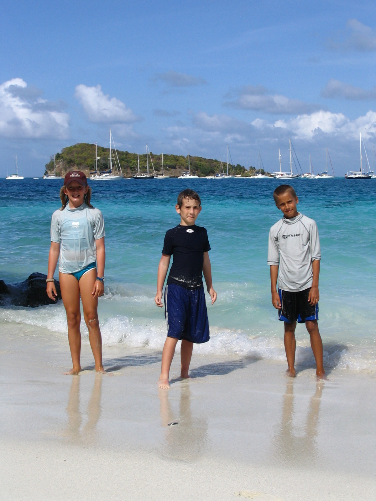
After St. Barth’s, we stopped for few days in St. Martin to re-provision and fix a few things on the boat and then sailed over to Road Bay, Anguilla. Anguilla is a part of the British West Indies and is a low, dry island. But it has some of the best water and beaches in the Caribbean. We anchored in Road Bay with a few other cruising boats. The harbor was full of green turtles. We had turtles around the boat the entire time we were there. Anguilla is a lot like the British Virgin Islands were 25 years ago.

IMG_0328

After a few days in Anguilla, it was time to head back to the BVI’s. Because of the distance, this sail has to be started in the evening so that you can arrive in daylight. We left Anguilla at 6:00 p.m. and headed to the north end of Virgin Gorda. At about 11:00 p.m., while in the Anegada Passage, we had a close encounter with a freighter. The freighter appeared in the distance and after monitoring it on our radar, it was clear that we were on a collision course. We hailed it on the radio repeatedly, but there was no response. We then made a severe course change and it passed just off our stern. Later that night we passed several cruise ships poking along. They typically leave one port in the late evening and then motor very slowly, sometimes circling, so that they do not arrive before dawn the next day. We arrived in Gorda Sound at about 10:00 a.m. the next day. We will cruise around the U.S. and Spanish Virgin Islands fora few more weeks before it will be time to head back to Texas (and start wearing shoes again).

IMG_0364 (1)

 Here is a link to all of the photos from the trip. Just click here to see some great photos!

Into the Windwards

The weather finally improved and we left the anchorage off the town of Anse Grande on the east side of the island of Terre-de-Bas and headed south for the island and country of Dominica. IMG_0167We anchored in Prince Rupert Bay off of the town of Portsmouth. Dominica is a very different place than the French countries where we have been spending a lot of time. A large, tropical, and mountainous island with only 70,000 residents. Extremely green and lush with 365 rivers. It also has 8 volcanoes, currently dormant, although they had a bad earthquake last October and another one (5.9 on the Richter scale) off the northeast coast several weeks ago. Parts of the island receive over 300 inches of rain a year. The economy is principally agrarian. Up and down the mountain sides people own plots of land called plantations (usually less than 1/2 acre) where they grow bananas, grapefruit, oranges, mango’s, and other fruits and many different types of spices. It is all done by hand. They all go up into the mountains in the morning in the backs of Toyota trucks and then come down in the evenings. No fertilizers or pesticides.

Everything is planted, picked, and boxed by hand. The bananas are all shipped to the British market. None to the U.S. They receive about 20 E.C. (Eastern Caribbean currency/about $8.00 U.S.) for a box of bananas, which take 9 months to grow. Lots of hard work. We spent a day touring the plantations with a local naturalist guide. We also went up into the mountains to the national parrot reserve. They have 2 parrot species that live only here. We saw quite a few of one species, the Jaco. Some of the trees in the rain forest are almost 200 feet tall and 40 feet wide. Huge trees.

IMG_0171We then hiked into the rain forest along a river up to a very large waterfall and pool. We all swam there. The water was very cold. We also drove over to the east side of the island and swam on a very remote beach (a long walk through the forest down a muddy trail) where they will begin filming “Pirates of the Caribbean II” soon. Most of the Dominica beaches are black because of the volcanic origin of the island.

An interesting sailing note. While we were in the anchorage in Prince Rupert Bay, Dominica, Greg on the J/44 sailboat we are traveling with heard a knock on the side of his boat one evening. He went up to see who was there and it was Rod Johnstone. Rod founded J/Boats and designed all of the J/Boat sailboats. His nephew is the captain of a big sailboat sailing around the Caribbean and he was down for a visit. He said he was a little surprised to look over and see a J/44 sitting in Dominica. He stayed and visited with Greg for about 30 minutes. After 4 days in Dominica, we left before sunrise for Martinique, another French island. It was a long day sail with the winds varying greatly. We had winds of 30 knots in a squall and we were in down to less than 10 knots for part of the way. For about an hour of the trip, we sailed along with a group of 50 smaller dolphins. About 1/2 the size of the dolphins you see along the Texas coast. We sailed into Anse Matin across the bay from Fort de France, the capital. The island looks like you are in a small town in France, nice roads and infrastructure, great restaurants and shopping, and nice people. We spent the day doing a major re-provisioning of the boat, refueling, and getting our laundry done. We left Anse Matin after 2 nights and sailed around to the anchorage at St. Anne on the southern tip of Martinique. A very nice, large anchorage in about 15 feet of water off a great sand beach. Most of the boats were European. Only a couple of American boats.

On the boat, everyone has started to get into the cruising routine. Every morning, we listen to the weather on the SSB radio from a guy, Chris Parker, who broadcasts for the entire Caribbean from his boat in the Bahamas. He is much more accurate and precise than NOAA and other public sources. We also listen to the BBC for news and to some of the radio chats that take place on the SSB radio in the morning that provide information about countries and anchorages. Even with the proliferation of cell and sat phones and email, most boat to boat communication still takes place on high frequency radio. After that, unless we are moving that day, we home school Haley, Cameron, and Travis. Some days go better than others, but it usually takes about 3 hours. Then we usually explore the island where we are anchored. On the boat, we have been able to manage our fresh water usage well. We are now using, on average, about 6 gallons of fresh water a day. Lots of Joy (it lathers in salt water) showers off the back of the boat. Since the boat holds about 200 gallons, this means we only have to get near a marina to fill up about every 30 days. Most of the islands do not have well water. On the smaller islands, rain water is caught and saved in water catchment devices, mainly on the roofs of buildings. Some of the bigger islands have desalination facilities. As a result, fresh water costs between $0.30 and $0.65 per gallon depending on the island. Diesel costs up to $3.50 per gallon. As we have moved south it has warmed up some. It is now about 85 degrees F during the day and 80 degrees F at night in the boat.

After 2 nights in St. Anne, Martinique, we left for the most northern port in St. Lucia, Rodney Bay. A relatively short sail of about 25 miles, but the wind was blowing 20 to 25 knots and we had 8 to 10 foot seas in the Atlantic passage. Once there, we anchored on the inside in the Rodney Bay lagoon. IMG_0201We spent a couple of days there doing boat maintenance. Boats always need work. After that we headed down the west coast of St. Lucia to the town of Soufriere. We picked up a mooring for the boat. No anchoring allowed in the area because the entire site is an underwater marine reserve. We had a coral reef under our boat in about 20 feet of water. Great snorkeling. The Pitons (2 small pointed mountains) were across the bay from us. The area is designated as a United Nations world heritage site. For all the sailing enthusiasts, the Pitons have been shown on the cover of Cruising World magazine many times. The town of Soufriere (Sulfur in French) is so named because it sits next to the crater of a dormant volcano that has an active hot springs that vent large amounts of steam and sulfur. We spent an afternoon at the volcano and springs. They have a public pool in the park where you can collect your own volcanic mud and take a mud bath and then soak in the spring water. The water is black and over 100 degrees F.IMG_0215

Although the standard of living in St. Lucia is less than the French countries, they seem to be trying hard to preserve the natural resources of the island.

After several more days in St. Lucia, we left again before sunrise for a long sail to Bequia, a small island about 9 miles south of St. Vincent. The weather was very squally with lots of rain showers. While sailing just north of St. Vincent, we saw many whale spouts. Humpback whales spend part of the winter in the southern Caribbean. (We sure did not want to hit one, because they are much bigger than the boat.) The island where we were headed, Bequia, was settled originally by whalers. They have a tradition of killing Humpback whales. Because of this tradition, the ICC grants Bequia the right to kill 4 Humpback whales each year between February and April. Just 2 days before we arrived they had killed their first whale this year (and, fortunately for the Humpback whales, the first one in several years). Everyone was talking about it. They are required to use traditional boats, which means 8 guys in a small wood boat with no motor and a harpoon thrown by hand. Once the whale is harpooned, it drags the 8 guys in the small wood boat around until it is exhausted.

IMG_0227

They then drag the whale to shore where it is butchered and the meat sold to the islanders. Bequia also has a long sailing and boat building history. They build colorful, wood sailing boats on the beach that are used for fishing and whaling.

After a few days in Bequia, we headed south into the Grenadines with our  irst stop in the Tobago Cays, an uninhabited group of small islands and reefs due east of Union Island and about 30 miles south of Bequia. They look like a combination of flats you would see in the Bahamas and small islands in the South Pacific. Large flats of white sand in less than 10 feet of water and beautiful white beaches.IMG_0261

Also, great snorkeling on a huge reef. While snorkeling, Cameron, Haley, and Travis have now identified over 50 different species of fish. Lots more to go. We have also seen lots of turtles, Hawksbills and Green turtles. The anchorage in the Tobago Cays is behind a reef in sand with nothing in front of you but thousands of miles of the Atlantic Ocean all the way to Africa. The waves pile up on the reef and the trade winds blow constantly from the east. A very pretty spot spot.  IMG_0262

Our next stop in the Grenadines was the island of Mayreau, a very small island with only 250 residents. A French estate owns the entire island except for 21 acres that was sold to the St. Vincent government for the town site. The town has no name, one road, a couple of cars, and just got electricity a couple of years ago. We ate dinner at a restaurant in the town, the Island Paradise. We were the only ones there. It was one of the better places we have eaten. We left there and sailed to Union Island next and anchored on the west side in Chatham Bay, a large uninhabited bay with great snorkeling. We will spend a few days here and then a week or so more in the Grenadines before starting north.

IMG_0230 IMG_0235

IMG_0240

Newer Posts
Older Posts