Menu Close

Cayuse

Sailing triplets

Day 2, Shira Crater Camp

Africa 026The next morning we are up at 6:30 a.m. for breakfast in the mess tent. Most everyone in our group has been awake much of the night, except for our kids. Everyone is still getting used to the effects of Diamox, which everyone in our group is taking. It is a drug that is supposed to improve the ability of your body to adjust to the altitude. It has significant side effects though, including being a strong diuretic.Africa 019 (1)

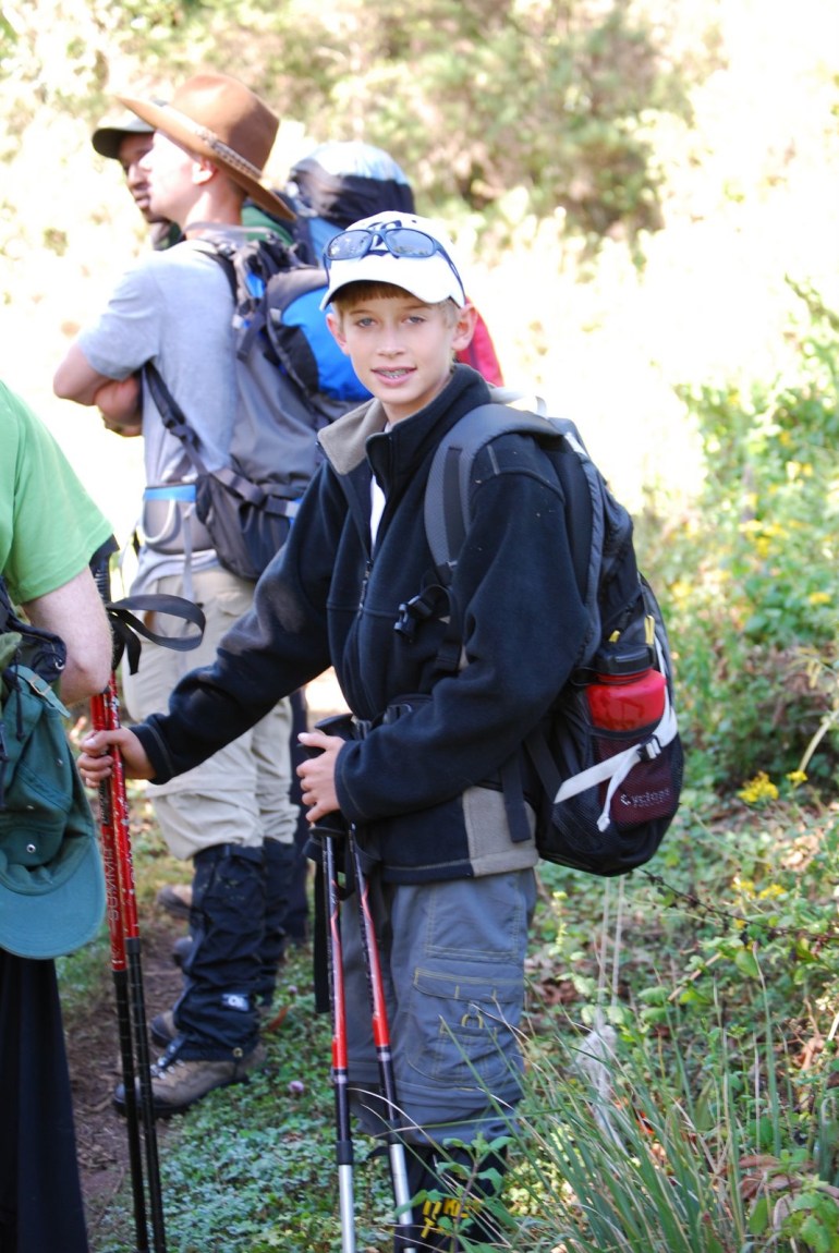
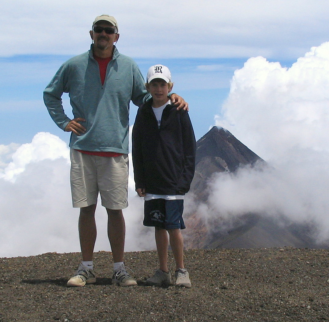
We leave the Forest Camp around 9:00 a.m. We are headed to the next camp site on the Shira Plateau at 11,500 feet, a 7 hour, mostly uphill, hike. We start out hiking through the remaining rainforest towards the large Moorland zone. After a few hours of hiking, we leave the tall trees and dense foliage of the rainforest. We see mostly heather and other shrubs. There also are many grasses, flowers, and small bushes growing in the area. We do not see any large animals, but lots of birds. The Moorland zone has several plants growing that are found only on the sides of Kilimanjaro at this altitude. They include the Senecio kilimanjari and the lobelia. Photos of both are in the Kilimanjaro slideshow. There are few mammals that live in the Moorland zone. The few that appear there are just passing through. We do not see any. After lunch, which we eat on the trail, we hike up a very steep trail to reach the top of the Shira rim, where we get to see the top of Mt. Kilimanjaro for the first time. It looks very high and a long way off. Our campsite is downhill from the Shira ridge in the Shira plateau or crater about 1 hour away. We arrive at the campsite at about 4:00 p.m. Several in the group have not drunk enough water during the day (including Hal) and have dehydration headaches when we get to the camp. Our guides suggest that we drink 4 to 5 liters of water a day. Some in our group are drinking 8 to 9 liters a day. The Shira crater once was the third volcanic peak on the mountain but has since erupted and collapsed inward and now only part of the eroded crater rim remains. That night it is clear and very cold, well below freezing, and everything left outside the tents freezes. But as soon as the sun hits the campsite in the morning it warms up dramatically.

Day 1, Londorosi Gate and Forest Camp

Africa 012 (1)
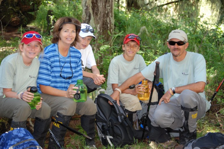
The next day, Friday, August 24, we are met at the hotel by our guides in an Austrian 6 wheel all terrain vehicle (similar to a Hummer) that holds 14 people in the back. We all get into the back of the truck with our gear. We drive for about 3 hours to reach the Londorosi Entrance Gate, which is the western entrance to the Kilimanjaro Park. After checking in with the Tanzanian park service about noon, we drive to the trailhead at about 7000 feet, where the road ends and the trail begins. It is not much of a road and is mostly mud. Our all wheel drive truck is slipping back and forth on the way up to the trailhead, where we unload all of our gear. The trail starts in the forest zone of Kilimanjaro. While hiking through the rain forest, we see several troops of Colobus Monkeys on the trail and signs of elephants, lots of dung and trails that they use to move through the forest, but we do not see any elephants. The elephants are hard to see because of the dense jungle foliage and because they shy away from humans. Buffalo, baboons, and several types of antelope also live in the forest zone. Many other types of mammals, including leopards and rhinos lived in the forest zone in the past, but they are now extinct on the mountain. The forest zone encircles all of Kilimanjaro between 5900 feet and 9200 feet. Most of the water on Kilimanjaro originates in the forest zone. We reach our campsite, the Forest Camp (at 9100 feet), around 5:00 p.m. That night, we eat dinner for the first time in the mess tent. Like all of the meals to come, it is very good. It consists of hot soup, pasta, potatoes, and fruit. After dinner, our guides bring in a birthday cake to the mess tent to celebrate Marsha’s birthday. Unknown to us, the guides carried the cake up the mountain from Moshi. They bring it into the mess tent singing “Happy Birthday” in Swahili. It is a nice end to the first day. After that, everyone goes back to their tent. The temperature drops rapidly at night on Kili. We sleep in 2 person waterproof tents in sleeping bags rated to minus 20 degrees F, with Marsha and Haley in a tent, Cameron and Travis in a tent, and Hal in a tent.

Africa 015

Africa 004

Moshi, Tanzania

We leave Houston around 3:00 p.m. on August 21 on a KLM flight to Amsterdam. We arrive in Amsterdam the next morning at around 7:00 a.m. after 9 hours of flying. After a 2 hour layover at Schipol, we fly from Amsterdam to Kilimanjaro Airport in Tanzania on an 8 hour KLM flight, arriving at 9:00 p.m. Needless to say, we are all very tired from traveling. We drive from the Kilimanjaro airport to our hotel in Moshi, Tanzania, which takes about an hour. The first thing that strikes us as we land at the airport and drive to Moshi is that it is very dark. It is dark in the airport with a few dim lights on and then it is very dark on the way to and in Moshi. The next day at the hotel we meet our 3 guides from Tusker, Tobias, Charles, and Steven, all residents of the Moshi area. We also meet our fellow climbers. There are 10 climbers in our group. The climbers include Jill, a 37 year old pastry chef at the Harvard Business School, her friend Peter, a 51 year old food services manager at the Harvard Business School, Ethan and Ben, two 18 year old recent high school graduates from Washington, DC (taking a year off from school before entering Harvard and Stanford next fall), Louis, a 47 year old senator from the Virgin Islands, and 5 Haltom’s (three 13 year olds and two 47 year olds). At our meeting, the guides go over all of the safety equipment for the climb and then check our gear to see if it is suitable for the climb.

Kilimanjaro

Hurricane season in the Caribbean shuts down most cruising. Cayuse is now tied up at a dock at Marios on the Rio Dulce near Fronteras, Guatemala. To take advantage of the available time, we are flying to Africa and joining a trek to climb Mt. Kilimanjaro in Tanzania. Kilimanjaro is the largest free standing mountain the world, rising from the African plain near Moshi, Tanzania on the border with Kenya. It also is one of the tallest volcanoes in the world, the tallest peak in Africa, and one of the 7 summits. It is 3 degrees below the equator and currently has two peaks, Mwenzi at 16,890 feet and the Uhuru Peak on Kibo at 19,340 feet. We are going to climb the Uhuru Peak on Kibo. In Swahili, the name of the mountain is Kilima-Ngiaro, which means “journey which has no ending.” The mountain was formed about 750,000 to 1 million years ago and originally consisted of 3 peaks, Kibo, Mwenzi, and Shira. Shira and Mwenzi have since erupted. The Shira peak has mostly collapsed and eroded and Mwenzi appears as a jagged peak at 16,890 feet to the east of Kibo (there is a photo of it late in the Kili slideshow). Because of its size and height, Kibo presents a real challenge to climb. The climb is mostly hiking, climbing, and scrambling. There are no significant technical aspects (ropes) to the climb, just lots of hiking and climbing up and down each day. If you are in reasonably good shape, the real challenges are presented by the altitude and the weather. About 15 climbers die each year from Acute Mountain Sickness on Kilimanjaro. There are no helicopters if you get into trouble. You have to walk down to the park entrance or be carried down in a stretcher by porters. The key is to go slowly or “poli poli” in Swahili, acclimatize to the thin air, recognize altitude sickness symptoms early on, and then respond to them. We have been training in Houston (walking, running, and climbing stairs) to get ready for the physical aspects of the climb, but, since we live at sea level, there is no way to know how we will respond to the high altitude. We will be on the mountain about 11 days. We will be back in mid-September and post blog updates of the trip then.

Volcano Acatenango

Antigua is surrounded by three volcanoes, Volcano Aqua, Volcano Acatenango, and Volcano Fuego. Acatenago is the tallest one and the third tallest peak in Central America at a little over 13,000 feet. Fuego is adjacent to Acatenango and is one of three active volcanoes in Antigua. We decided to hike up Acatenango with part of another family from the school and a guide. We started at 6:00 a.m. after an hour drive in a van. We begin on the road at an altitude of about 7400 feet and begin climbing through corn fields planted on the side of the volcano. At the start, the temperature was in the upper 50’s, it was cloudy, and the wind was blowing. The trail for most of the day was straight up the side of the volcano. The trail could have used a few more switchbacks. The soil was very loose volcanic dirt which made it difficult to keep your footing while hiking. We were constantly sliding around and falling. We arrived at the top around 1:00 p.m. after 7 hours of hiking and vertically ascending 5600 feet. We ate lunch at the top. The views from the top were incredible. Looking west we could see the Pacific Ocean. Looking north, we could see the border of Guatemala and Mexico and many of Guatemala’s 29 volcanoes. The top of Acatenango is a large crater. Even though it is considered dormant, steam vents dot the crater. Volcano Fuego is next to Acatenango and is quite active. Several minor eruptions of Fuego occurred while we were standing on the summit of Acatenango. After about an hour on the top, we headed down and arrived back at the road at the bottom of the trail around 4:00 p.m. It was a long day of climbing and we were all very tired. The photo above is of Cameron and Hal standing on the edge of the Acatenango crater with the slightly lower summit of Fuego in the background.

Belize Outer Cays

Belize 081 (2)

We left Placencia, Belize to see some of the cays between the mainland and the barrier reef. Our first stop was Laughing Bird Cay, which is a World Heritage Site and a Belizean park. The cay is named after the Laughing Gull, which used to nest on the island. The cay is a small sand island with palm trees that trends northeast to the southwest along a shallow reef structure. We anchored on the west side. The cay is surrounded by reefs from 10 to 30 feet deep, which makes for great snorkeling. We saw most the usual tropical fish that hang out around here, including several Goby fish, trunk fish, large rays, and a small nurse shark. While we were there, the wind blew out of the northeast, which meant the island did not provide much protection from the waves and the boat was bucking around pretty hard in the wave action. It seemed like we were at sea even though we were hanging off an anchor. After Laughing Bird Cay, we sailed over to Long Cocoa Cay. It is an uninhabited mangrove cay that provided good protection from the northeasterly winds. It also had some nice coral in shallow water. There were lots of small coral heads in less than 8 feet of water. Early this week, we are going to try to take our deeper draft boat up the Rio Dulce River in Guatemala. The bar at the entrance to the river has a controlling depth of about 6 feet at mean low water. Our boat draws 6.7 feet. We are going to cross at high tide and hope that adds some additional depth at the bar. If we get across, we will check into Guatemala in Livingston and then head up the river to the town of Fronteras.Belize 080Belize 079

Cockscomb Basin Wildlife Sanctuary

Belize 057 (1)

In the early 1980’s, a conservationist named Alan Rabinowitz came to Belize to study the jaguar (one of the prettiest big cats) and its habits. He spent two years tracking jaguars in the area that was to become the Cockscomb Basin Wildlife Sanctuary (CBWS). He wrote a book called “Jaguar” after completion of the study. The book and study resulted in an effort by the Belize Audubon Society (BAS) to establish CBWS. It was established in 1986 on 128,000 acres of rainforest at the base of the Maya mountains to protect the habitat of the jaguar. The sanctuary is run by BAS. Having been members of BAS for almost 20 years, we were very interested in seeing the sanctuary. It took us about 2 hours to get there by van from Placencia. According to the ranger at CBWS, there are about 60 jaguars living in 13 different areas in the sanctuary (determined by radio tracking collars) along with many other animals, including tapir, parrots, parakeets, and the Fer-de-lance viper. The jaguar is very elusive, travels mostly at night, and stays away from humans. The ranger, who had worked for BAS at the CBWS for 4 years, had never seen a jaguar. Only a very small portion of CBWS is open to the public. About 10 trails are available for hiking through the surrounding rainforest. We spent the morning hiking several trails, and then in the afternoon, we hiked to a waterfall and swam in a pool below the waterfall. There also was a natural rock slide in the river at the waterfall. The jungle was very dense along the trails and allowed almost no sunlight to reach the jungle floor. Many of the trees were 80 to 100 feet tall, with howler monkeys in the treetops. Also, it rained lightly most of the time we were there. The jungle was so dense we were expecting to see a T-Rex come lumbering out of jungle at any moment. At the end of the day, we had some excitement. The guy we hired to take us in his van to CBWS lost his keys in the river. This meant our backpacks were locked in his van and we did not have a way to get back to Placencia. To get our backpacks, we were able to find a stiff piece of wire and open the front door through the window by pulling up on the lock. Fortunately, it was an old van with old style locks with a flat head (many of the cars in Belize are used cars from Texas that still have the old Texas inspection sticker on the window). After we got the van open, the BAS ranger found a local taxi to cart us to the highway (there is only one paved major road in southern Belize). We then caught the local bus (affectionately known as the “chicken bus”) to the town of Independence. From there, we walked about a mile and caught the water taxi to Placencia.

Placencia, Belize

Belize 056

After spending time in northern Belize, we are now anchored off of the town of Placencia in southern Belize. It took us several days to work our way down inside the barrier reef stopping at several of the uninhabited cays along the barrier reef at night. Placencia is a small town on a peninsula on the mainland with a small off lying cay that provides good protection from the easterly winds. Travis is driving Cayuse above.

Belize 088 (1)

Lamanai – Submerged Crocodile

Belize has over 800 known Mayan sites, with most of them unexcavated. We visited the Mayan site at Lamanai (which means submerged crocodile in the Mayan language). It is located on the New River in the Orange Walk district of Belize. Getting to Lamanai required several boat rides up jungle rivers, including a 29 mile boat trip up the New River. The site is surrounded by the jungle, with several troops of Howler monkeys in the trees at the site. The site has 730 known buildings with only 4 that have been completely excavated. The others consist of mounds covered by the jungle. The Mayans thrived at Lamanai longer than any other Mayan site. They were there for more than 3000 years beginning in 1500 BC and continuing until the Spanish arrived in 1544. The peak population was around 40,000. During the peak of the Mayan civilization in Belize, archaeologists believe there were more than 750,000 Mayans living in Belize. Contrast that to the current population of Belize now of around 250,000. The main temple at Lamanai which is 120 feet tall has incredible views of the surrounding jungle from the top. Since the Mayans were at Lamanai for such a long time, many of the temples and buildings have multiple layers and facades. When a new ruler came into power, he or she would build over exterior the existing temple or building, which resulted in many layers that continued to change over time. On the boat rides to and from the site, we saw many birds and other wildlife, including a Jabiru stork, the biggest flying bird in the Western hemisphere and one of the largest birds on the planet, a pacca, which is a medium sized rodent that sort of barks like a dog, and lots of crocs.

Belize 020 Belize 025 Belize 039

Caye Caulker, Belize

We are in Caye Caulker, Belize after staying 2 days anchored off San Pedro. It is a funky, pleasant place with a few sand streets, about 800 residents, a very nice anchorage, and pretty water behind the barrier reef. We will be here for a few days before moving south to Belize City. The water in the area is very shallow. We hit the bottom several times on our way here from Ambergris Cay. It may be a bit of challenge to make it to Belize City with our deeper draft boat.

Yucatan 061 Yucatan 069 Yucatan 065

Newer Posts
Older Posts