Menu Close

Cayuse

Sailing triplets

Newport to Bermuda Race

Cameron and I crewed on our friend’s Little Harbor 53, Chasseur, in the 2012 Newport to Bermuda Race. We had 4 days of fast beam reaching with the wind completely dying just as we arrived in Bermuda. It was a great sail.

Photos of the race are at this link.  Bermuda Race Photos

Bermuda

Pebble Beach Golf

Travis, Cameron, and I took my dad to Monterey to play golf for his 80th birthday. The trip got off to a rocky start when we missed our SWA flight at Houston Hobby Airport due to an accident on the freeway. We did not get to Monterey that day until well after midnight, but we were up early the next day ready to play. While there, we played the Laguna Seca Golf Course, Poppy Hills Golf Course, Spyglass Hill Golf Course, and Pebble Beach. The weather was very nice, we survived the poa annua grass greens, and had a great time. We also saw lots of cool cars in Monterey because the Pebble Beach Concours d’Elegance car show was underway while we were there.

See a link to all photos from the trip here.  Pebble Beach Golf

Golf

Quetico Canoeing Trip

Travis, Cameron and I went on a 10 day Boy Scout canoeing, backpacking and portaging trip in Quetico Provincial Park, which is a series of lakes and wetlands north of Duluth, Minnesota. We ran into lots of mosquitos but very few people, other than those in our group, and had a terrific trip.

Photos of the week are at at the link below.

Quetico Photos

Lake Manyara and Ngorongoro Crater

After climbing Kilimanjaro, we are off to see two of Tanzania’s best game reserves, Lake Manyara and the Ngorongoro Crater. Both are World Heritage Sites. Lake Manyara National Park lies on the western side of the Great Rift Valley. The park covers 129 square miles of which Lake Manyara covers 89 square miles. The lake is one of the Rift Valley’s soda or alkaline lakes. (Ernest Hemingway called it the loveliest lake in Africa.) The Ngorongoro Crater is part of the larger Ngorongoro Conservation Area and was formed about 2 million years ago when a giant volcano exploded and collapsed. The crater is the largest intact volcanic caldera in the world. The steep sides of the crater mean that it has become a natural enclosure for a very wide variety of wildlife. It is estimated that over 30,000 animals live in the crater, including most of the species found in East Africa. There are about 15 black rhinos in Ngorongoro which is one of the last populations of black rhinos in the wild. This is down from over 100 black rhinos in Ngorongoro thirty years ago. If you are lucky you can see the rest of the big five, lion, leopard, buffalo, and elephant, in the crater, one of the few remaining places in Africa where you can still do so.

We meet our guide at the Keys Hotel and start driving west toward Arushu. After Arushu (at the base of Mt. Meru), we drive to Lake Manyara. We are staying that night in a tented lodge on the western edge of the Rift Valley looking east over Lake Manyara. We head into the park around 2:00 p.m. and drive down to the edge of the lake. On the way into the park we see baboons first and then start to see some of the animals that live in or pass through the Lake Manyara area, including elephants, hippos, zebras, cape buffalos, giraffes, huge pelicans, eagles, and flamingos. Sometimes there are so many flamingos in the lake it appears pink. There are no fences and the animals can move into or out of the park as they wish, sometimes over to Ngorongoro or the Serengeti. They prefer the park though because there is abundant fresh water and, better yet, no humans. The next morning we get up early and drive west to the Ngorongoro Crater entrance. The crater rim rises 2000 feet or so above the surrounding plain. We drive to the top of the rim and then back down into the crater. It is the dry season so the grasses are mostly brown, but they are very thick. There is plenty of fresh water from springs flowing into the crater and it is very cool. We are all wearing jackets. We were never warm while in Tanzania even though we spent the entire time 4 degrees south of the equator. Huge herds of cape buffalo, zebra, and wildebeest roam the crater floor. There are about 7 prides of lions in the crater (or about 100 lions). There also are leopards in the forests along the crater rim. We spend all day driving through the park and then return to our hotel on the crater rim the first day. At one point, we get to see 7 lions surround 5 warthogs and then move in to kill one of the warthogs for lunch. The second day we are up before sunrise and drive down into the crater to see the animals when they are most active. After driving through the crater in the morning, we leave Ngorongoro and drive to Arusha and then on the Kilimanjaro airport to catch our KLM flight to Amsterdam that night. We have a wonderful time in Tanzania. It is a beautiful place. We hope to return soon.

Photos from Africa can be found under this link.   Africa Photos Click Here  Use the Slideshow button to view the photos.

Days 8 & 9, Mweka Camp and Park Gate

Africa 121

The next morning we leave the Kosovo camp heading down. We do not go down the way we came up. We are going down the Mweka Route, which is trail that is too steep for ascending and only is used to go down. We hike for about 4 hours, at a very fast pace, until we reach the Mweka camp at about 10,000 feet. While going down is easy on your lungs, it is very hard on your legs and feet. It is hard to keep your toes from continually banging into the end of your boot. We reach the Mweka camp around 2:00 p.m. and take it easy for the rest of the day. It is very nice to be able to breathe deeply. Sleeping is easy at 10,000 feet. The next morning we are up at 6:00 a.m. Everyone, including the guides and porters, is ready to get down the mountain and into town. We arrive at the park gate at about 10:30 a.m. and sign out. We get in the Tusker truck and drive back to the Keys Hotel for lunch and a short award ceremony where everyone gets their certificate for reaching the summit of Kilimanjaro.

Africa 120

Day 7, Summit Day

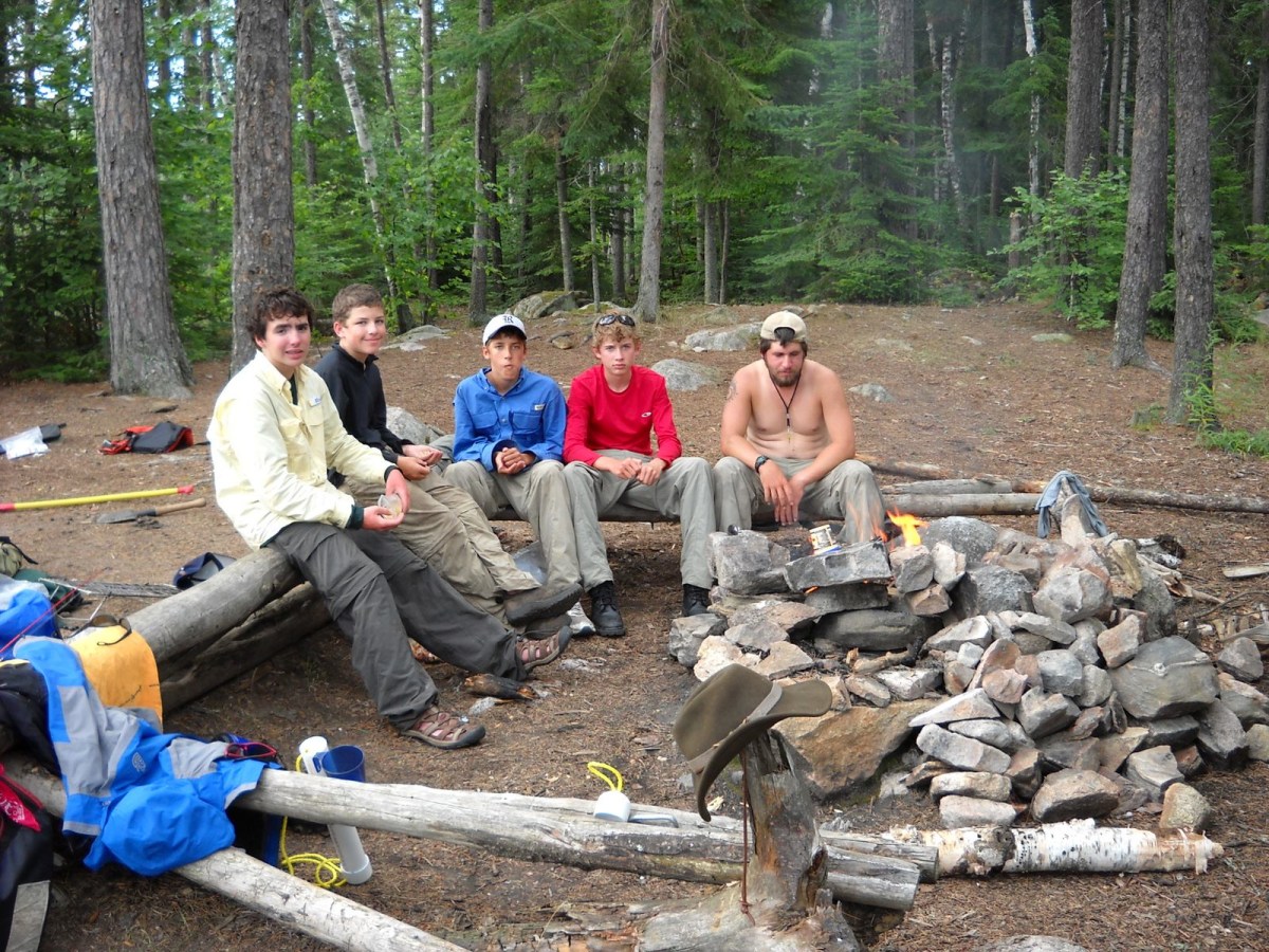
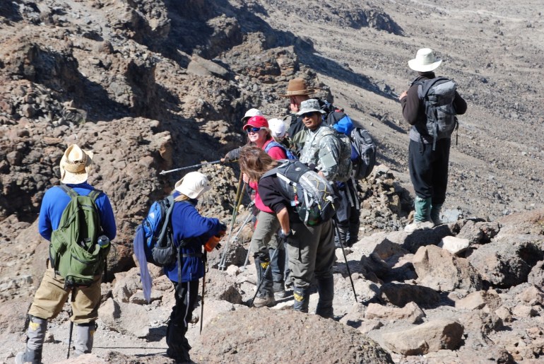
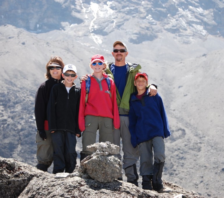
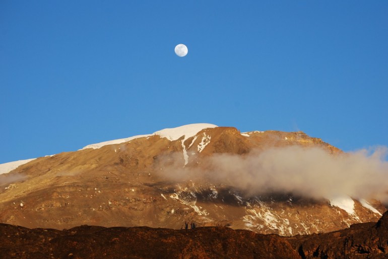
We wake up at 5:00 a.m. on summit day, Thursday, August 30. We have a quick breakfast in the mess tent. It is cold and clear and a great day to try and reach the summit. Everyone is ready to go, except Marsha. She does not feel well and has developed some stomach problems (probably from the food or water). She takes some medicine and our guides suggest that she start climbing and see how it goes. She can always come down. We start up towards the summit. The ground is mostly loose rocks, small boulders, and lots of volcanic dust. There is not much of trail and we just wind our way mostly upward, very slowly. It is more difficult to breathe and several in the group have mild to moderate altitude headaches. Acute Mountain Sickness (AMS) results from the decreased air pressure at altitude. The decreased air pressure allows excess fluid to accumulate in your body. This affects the eyes, brain, and lungs. The swelling and excess fluid on the brain leads to nasty, persistent headaches. It also can lead to the build up of fluid in the lungs, particularly after sleeping at high altitude. In rare cases, it can lead to a fatal pulmonary edema or cerebral edema. So on summit day our guides are watching everyone closely to see if they are exhibiting symptoms of AMS, headaches, confusion, and difficulty breathing. More than half the group starts taking dexamethesone tablets to combat a bad altitude headache (it is a steroid, Advil does not work). After about an hour Marsha is feeling worse and looks she might have to descend with one of the guides. But our head guide, Tobias, suggests that she try it just a little longer, to the next break point. He makes her drink lots of water with dehydration salts and then puts her at the head of our climbing line and makes everyone else walk behind her. We continue like this, very slowly, for several hours following her all the way to crater rim at about 19,000 feet. On the way up, we pass other climbers coming down that did not make it for one reason or another. As it turns out, our slow pace works well for everyone in the group. We all make to the crater rim about 11:00 a.m., where we stop for a longer break. The Kilimanjaro crater is huge and is covered in snow. We enter the crater on the south side and we can see the great northern glacier across the crater that covers the northern summit of Kilimanjaro. When Hans Meyer first reached the summit of Kilimanjaro in the late 1800’s, he found that the entire peak of Kili down to about 18,000 feet was covered with permanent ice, including the crater, which was filled with snow and ice. Today, the crater is ice free and only a few glaciers remain around the perimeter of the crater rim. The remaining glaciers are rapidly melting and are expected to be gone soon. It is a real treat to be able to see the Kilimanjaro glaciers. After the break, we start hiking along the western crater rim toward the Uhuru Peak, the highest point on Kilimanjaro. We reach the summit at about 12:30 p.m. after hiking another hour. It is a beautiful day, partly cloudy and not much wind. Cameron, Haley, and Travis lead the way to the summit and are the first in our group to get there. It is quite a feat for a thirteen year old to reach the summit of Kilimanjaro, much less three at the same time. Our guide company, Tusker, has been taking people up Kilimanjaro for 31 years and they have never had anyone reach the summit younger than 15 years old (they are so surprised that want copies of their passports to confirm their ages). According to the park rangers, only a very small number of kids under 15 even make an attempt to reach the summit each year, and many do not make it. Cameron, Haley, and Travis are some of the youngest climbers to ever reach the summit of Kilimanjaro, and most certainly the youngest triplets ever to do so. After about an hour on the summit, we start descending. It is much faster going down. It only takes us about 3 hours to climb down to the Kosovo camp. Everyone is exhausted, but very pleased that they reached the summit.

Day 6, Kosovo Camp

We start about 9:00 a.m. today. This will be a shorter hiking day. We only will hike for about 4 hours. We leave Karanga headed for the Barafu camp at about 15,000 feet. Barafu is the main camp where folks start their summit attempt of Kilimanjaro and several trails converge at Barafu. We arrive at Barafu around lunch. Tobias, our lead guide, has gone to see the Kilimanjaro park rangers to see if he can get permission for us to hike on up the mountain another hour or so to the Kosovo campsite (which is not a regular site) just above Barafu. By moving on up today, it will make our summit attempt tomorrow a little shorter. Also, there will be no climbers at the Kosovo site other then our group so it should be a nicer spot. After lunch, we learn he received permission from the ranger so we pack up and hike up a very steep trail (lots of large boulders) to the Kosovo campsite at 16,000 feet. We arrive around 3:30 p.m. which gives us a little bit of time to unwind and get ready for tomorrow. The Kosovo campsite is in the summit zone of Kilimanjaro where the oxygen level is about half that at sea level. It is like breathing on one lung. There also is little atmosphere to protect you from the sun. No mammals live in this zone, but there are two interesting stories about animals that have appeared there in the past. In 1926, a German missionary found a leopard frozen in the snow near the crater rim of the summit and he cut off its ear as proof. And in 1962, three climbers were followed to the summit by five wild African hunting dogs, who watched as the climbers signed the log book at the summit and then disappeared. We do not see any animals. That evening, we eat dinner around 6:30 p.m. and everyone is off to their sleeping bag early. The plan for tomorrow is get up at 5:00 a.m. and start out for the summit.

Day 5, Baranco Wall and Karanga Camp


Africa 080
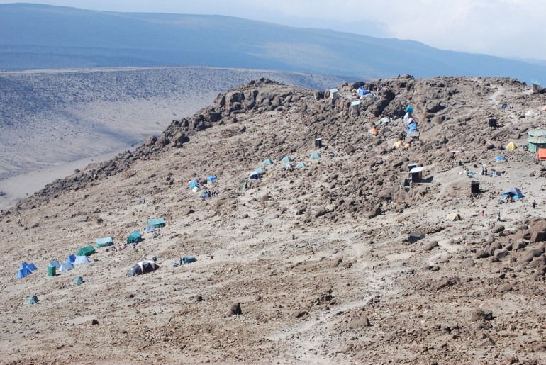
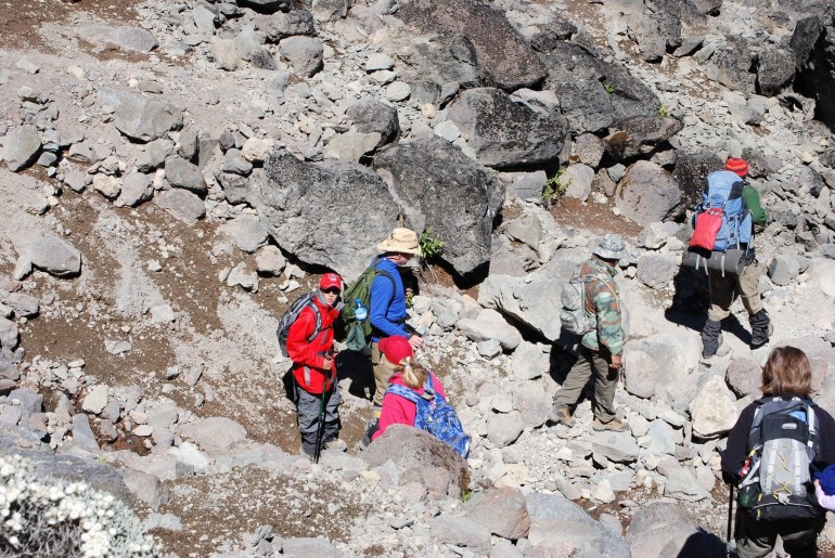
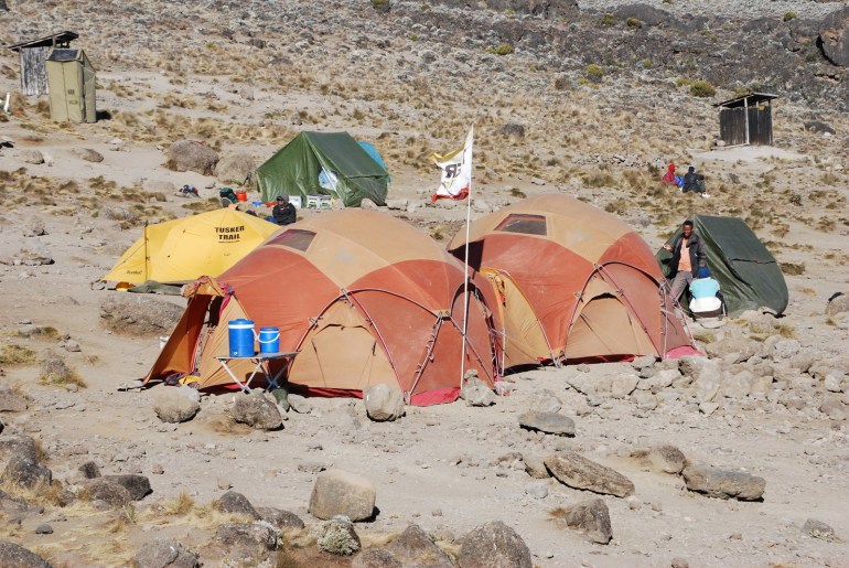
Today we start out by climbing up the Baranco wall, a massive 1000 foot vertical lava flow. It is mostly straight up from the stream valley. When you first see it, it is hard to imagine that there can be a trail on it. For some of the time, we use ropes so that if we fall we will not go all the way to the bottom. After we get to the top of the Baranco wall, the climb becomes more gradual. We continue on upward until we get to the ridge at about 14,100 feet. We then begin descending through the Karanga Valley towards the Karanga camp, at 13,200 feet. The Karanga camp is on a very rocky slope facing southwest. At night, we can see lights from the town of Moshi. It looks like you are seeing it out of an airplane window it is so far below us. During the night, the wind picks up gusting at times to about 30 knots and several times it seems like it is going to pick us up inside our tents. Because of the wind, it is very cold outside of the tents that night. We have to make a run for it between the mess tent and our tents. At this altitude, the vegetation is mostly gone. We are camped on an old sloping lava flow with lots of large rocks and boulders.

Day 4, Lava Tower and Baranco Camp

Africa 076

We are up early again to get ready for a long day. Starting at 13,600 feet, our plan is to hike up to the Lava Tower at 15,000 feet, try to arrive by 12:30 p.m. or so, eat lunch, and then hike down to the Baranco camp at 12,800 feet. It will make for along day, but the big changes in altitude are all part of our guides’ efforts to get our bodies to acclimatize to the higher altitude (“climb high, sleep low”). In the morning, Hal has a slight headache again which is not responding to Advil. We leave the Moir camp around 8:30 a.m. and hike steadily uphill until lunch, gaining about 1500 feet in altitude. For the first time, we start to see other climbers as the Lemosho trail (the one we are on) joins up with the Machame route near Lava Tower. By the time we reach Lava Tower at 15,000 feet, Hal has a nasty altitude headache, which makes it hard to eat lunch. The others eat lunch at Lava Tower and then we start down the trail to the Baranco camp, arriving there about 4:30 p.m., dropping about 2200 feet in altitude. Shortly after we arrive at the Baranco camp (12,800 feet), Hal’s headache is gone. Everyone else feels great and is not affected by the altitude. The Baranco camp is in a spectacular spot, right on the banks of a glacier mountain steam (our drinking water) and just below the western glaciers of the Kibo peak (6300 feet above us). Everyone is tired after another long day of hiking up about 1500 feet and then down 2200 feet. The weather again is clear and cold at night with a full moon and lots of stars. We are in the southern hemisphere now so we see some constellations that are new to us.


Day 3, Moir Camp

We leave the Shira campsite again around 9:00 a.m. for a 6 to 7 hour hike to the Moir camp. The Moir camp is at 13,652 feet. The hike today is not as steep as the day before with mostly a gradual upward slope. We eat lunch on the trail again and arrive at the Moir camp at about 3:30 p.m. Just before we get to the campsite, we pass the skull and bones of an elephant that apparently got lost and wandered up too high. We are now in the highland desert on Kilimanjaro, where it is “summer every day, and winter every night.” There is very little water and there are huge daily fluctuations in temperature. It can be very warm in the sun during the day, but, at night, it is well below freezing. There are hardly any plants left at this altitude because the air has started to get very thin. We only see a few hardy grasses, flowers, and lichens. It looks like photos of the surface of the moon. When we arrive at the camp, everyone is doing well. The eastern edge of the camp has a larger wall of lava flow where many people have written their name with a rock. Haley and Cameron write their names on the rock wall. The campsite is on mostly rocks and broken lava. That night we have another great meal whipped up by our cook and everyone is off to their tent just after dark. It is again clear and very cold. At that altitude, the day’s heat disappears very quickly after the sun sets.

Newer Posts
Older Posts