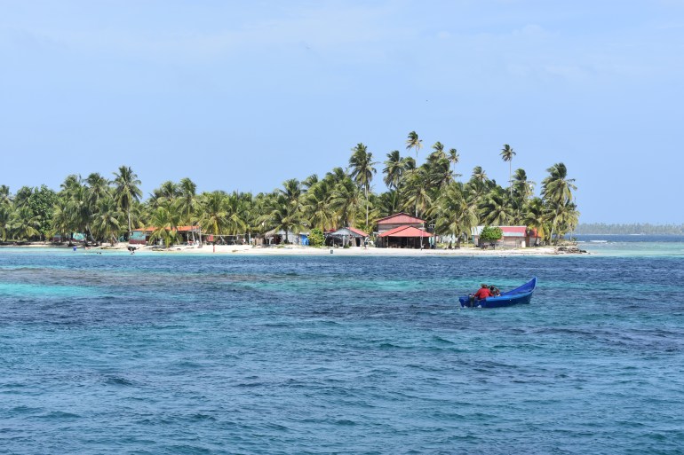
After spending 6 days in Santa Marta, we departed at noon on Wednesday for the San Blas islands. The course is 280 miles, but you have to sail northwest for about 40 miles to get offshore far enough to get clear of all the debris in the water from the rivers in Colombia. We saw lots of trees and stumps in the water, but fortunately did not hit anything. The wind gusted up to 32 knots during the first few hours dropping off to about 25 knots for the rest of the trip. Seas were 6 to 8 feet with occasional larger seas. We started with a double-reefed main and about 50% of the jib. The San Blas islands have numerous reefs and cays, all unmarked and unlit. On top of that, the charts are based on very old surveys in the 1800s and known to be inaccurate. Our goal was to arrive Friday morning at daybreak but the boat was going way too fast. About 30 miles out, we dropped the main and rolled up almost all the jib, but we were still going 4.5 knots to 5 knots under essentially bare poles. The boat handled and sailed surprising well with no sails in the big waves. About 10 miles out, we fore-reached for a couple for hours to wait for the sun. It also was raining with lots of lightning and thunder and no moon. It was so dark that we could not see the horizon except in the lightening strikes. It made for a very exciting landfall! The San Blas islands and the associated mainland territory are called the Kuna Yala and the area is inhabited by the Kuna Indians. They control this quarter of Panama. They live on may of the cays in the islands and are most famous for the molas sold by the Kuna women. Each mola is different representing abstract forms of birds, animals, or marine life. We anchored the first day in the Swimming Pool in the western Holandes Cays. We have few days to explore the San Blas before we sail over to Colon and the Panama Canal.


You must be logged in to post a comment.