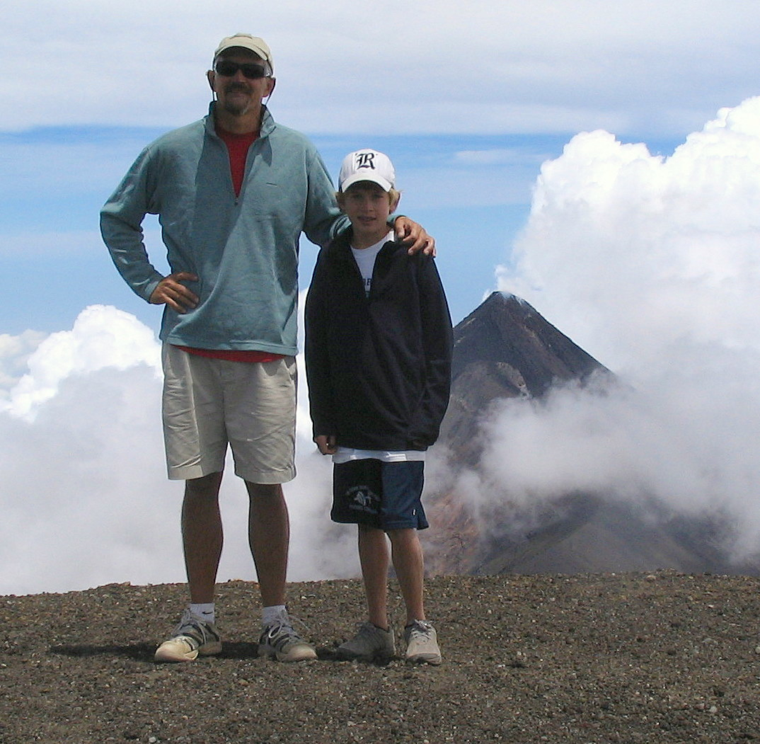
Antigua is surrounded by three volcanoes, Volcano Aqua, Volcano Acatenango, and Volcano Fuego. Acatenago is the tallest one and the third tallest peak in Central America at a little over 13,000 feet. Fuego is adjacent to Acatenango and is one of three active volcanoes in Antigua. We decided to hike up Acatenango with part of another family from the school and a guide. We started at 6:00 a.m. after an hour drive in a van. We begin on the road at an altitude of about 7400 feet and begin climbing through corn fields planted on the side of the volcano. At the start, the temperature was in the upper 50’s, it was cloudy, and the wind was blowing. The trail for most of the day was straight up the side of the volcano. The trail could have used a few more switchbacks. The soil was very loose volcanic dirt which made it difficult to keep your footing while hiking. We were constantly sliding around and falling. We arrived at the top around 1:00 p.m. after 7 hours of hiking and vertically ascending 5600 feet. We ate lunch at the top. The views from the top were incredible. Looking west we could see the Pacific Ocean. Looking north, we could see the border of Guatemala and Mexico and many of Guatemala’s 29 volcanoes. The top of Acatenango is a large crater. Even though it is considered dormant, steam vents dot the crater. Volcano Fuego is next to Acatenango and is quite active. Several minor eruptions of Fuego occurred while we were standing on the summit of Acatenango. After about an hour on the top, we headed down and arrived back at the road at the bottom of the trail around 4:00 p.m. It was a long day of climbing and we were all very tired. The photo above is of Cameron and Hal standing on the edge of the Acatenango crater with the slightly lower summit of Fuego in the background.