The weather finally improved and we left the anchorage off the town of Anse Grande on the east side of the island of Terre-de-Bas and headed south for the island and country of Dominica. 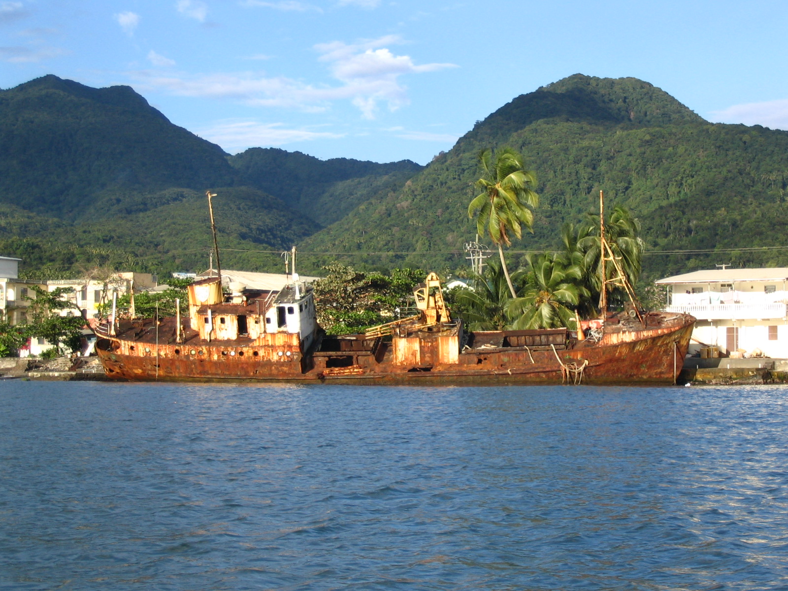 We anchored in Prince Rupert Bay off of the town of Portsmouth. Dominica is a very different place than the French countries where we have been spending a lot of time. A large, tropical, and mountainous island with only 70,000 residents. Extremely green and lush with 365 rivers. It also has 8 volcanoes, currently dormant, although they had a bad earthquake last October and another one (5.9 on the Richter scale) off the northeast coast several weeks ago. Parts of the island receive over 300 inches of rain a year. The economy is principally agrarian. Up and down the mountain sides people own plots of land called plantations (usually less than 1/2 acre) where they grow bananas, grapefruit, oranges, mango’s, and other fruits and many different types of spices. It is all done by hand. They all go up into the mountains in the morning in the backs of Toyota trucks and then come down in the evenings. No fertilizers or pesticides.
Everything is planted, picked, and boxed by hand. The bananas are all shipped to the British market. None to the U.S. They receive about 20 E.C. (Eastern Caribbean currency/about $8.00 U.S.) for a box of bananas, which take 9 months to grow. Lots of hard work. We spent a day touring the plantations with a local naturalist guide. We also went up into the mountains to the national parrot reserve. They have 2 parrot species that live only here. We saw quite a few of one species, the Jaco. Some of the trees in the rain forest are almost 200 feet tall and 40 feet wide. Huge trees.
 We then hiked into the rain forest along a river up to a very large waterfall and pool. We all swam there. The water was very cold. We also drove over to the east side of the island and swam on a very remote beach (a long walk through the forest down a muddy trail) where they will begin filming “Pirates of the Caribbean II” soon. Most of the Dominica beaches are black because of the volcanic origin of the island.
An interesting sailing note. While we were in the anchorage in Prince Rupert Bay, Dominica, Greg on the J/44 sailboat we are traveling with heard a knock on the side of his boat one evening. He went up to see who was there and it was Rod Johnstone. Rod founded J/Boats and designed all of the J/Boat sailboats. His nephew is the captain of a big sailboat sailing around the Caribbean and he was down for a visit. He said he was a little surprised to look over and see a J/44 sitting in Dominica. He stayed and visited with Greg for about 30 minutes. After 4 days in Dominica, we left before sunrise for Martinique, another French island. It was a long day sail with the winds varying greatly. We had winds of 30 knots in a squall and we were in down to less than 10 knots for part of the way. For about an hour of the trip, we sailed along with a group of 50 smaller dolphins. About 1/2 the size of the dolphins you see along the Texas coast. We sailed into Anse Matin across the bay from Fort de France, the capital. The island looks like you are in a small town in France, nice roads and infrastructure, great restaurants and shopping, and nice people. We spent the day doing a major re-provisioning of the boat, refueling, and getting our laundry done. We left Anse Matin after 2 nights and sailed around to the anchorage at St. Anne on the southern tip of Martinique. A very nice, large anchorage in about 15 feet of water off a great sand beach. Most of the boats were European. Only a couple of American boats.
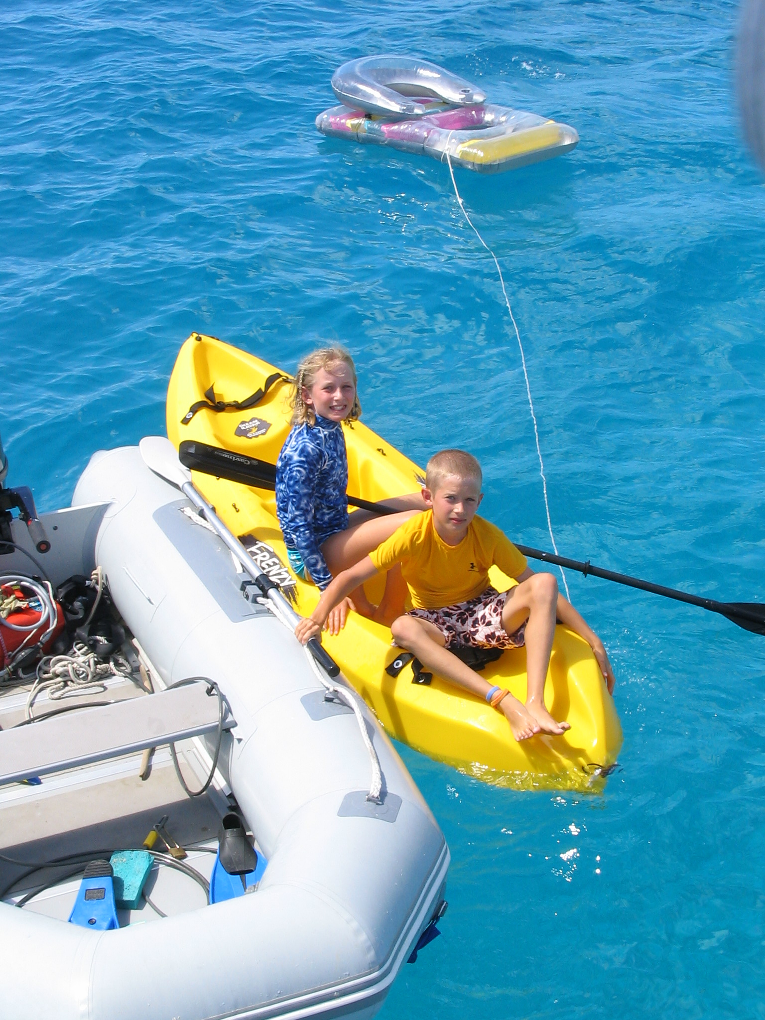
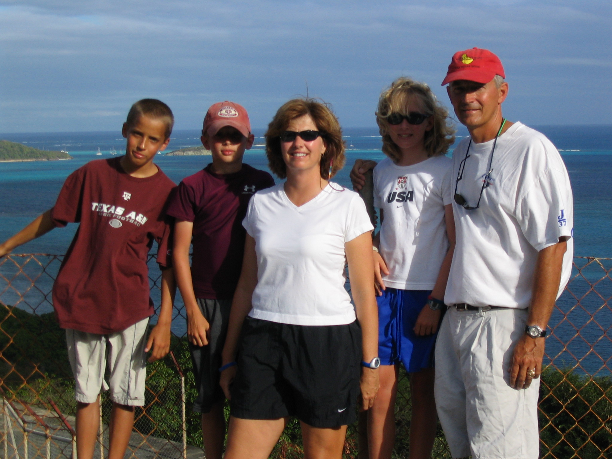
On the boat, everyone has started to get into the cruising routine. Every morning, we listen to the weather on the SSB radio from a guy, Chris Parker, who broadcasts for the entire Caribbean from his boat in the Bahamas. He is much more accurate and precise than NOAA and other public sources. We also listen to the BBC for news and to some of the radio chats that take place on the SSB radio in the morning that provide information about countries and anchorages. Even with the proliferation of cell and sat phones and email, most boat to boat communication still takes place on high frequency radio. After that, unless we are moving that day, we home school Haley, Cameron, and Travis. Some days go better than others, but it usually takes about 3 hours. Then we usually explore the island where we are anchored. On the boat, we have been able to manage our fresh water usage well. We are now using, on average, about 6 gallons of fresh water a day. Lots of Joy (it lathers in salt water) showers off the back of the boat. Since the boat holds about 200 gallons, this means we only have to get near a marina to fill up about every 30 days. Most of the islands do not have well water. On the smaller islands, rain water is caught and saved in water catchment devices, mainly on the roofs of buildings. Some of the bigger islands have desalination facilities. As a result, fresh water costs between $0.30 and $0.65 per gallon depending on the island. Diesel costs up to $3.50 per gallon. As we have moved south it has warmed up some. It is now about 85 degrees F during the day and 80 degrees F at night in the boat.
After 2 nights in St. Anne, Martinique, we left for the most northern port in St. Lucia, Rodney Bay. A relatively short sail of about 25 miles, but the wind was blowing 20 to 25 knots and we had 8 to 10 foot seas in the Atlantic passage. Once there, we anchored on the inside in the Rodney Bay lagoon.  We spent a couple of days there doing boat maintenance. Boats always need work. After that we headed down the west coast of St. Lucia to the town of Soufriere. We picked up a mooring for the boat. No anchoring allowed in the area because the entire site is an underwater marine reserve. We had a coral reef under our boat in about 20 feet of water. Great snorkeling. The Pitons (2 small pointed mountains) were across the bay from us. The area is designated as a United Nations world heritage site. For all the sailing enthusiasts, the Pitons have been shown on the cover of Cruising World magazine many times. The town of Soufriere (Sulfur in French) is so named because it sits next to the crater of a dormant volcano that has an active hot springs that vent large amounts of steam and sulfur. We spent an afternoon at the volcano and springs. They have a public pool in the park where you can collect your own volcanic mud and take a mud bath and then soak in the spring water. The water is black and over 100 degrees F.
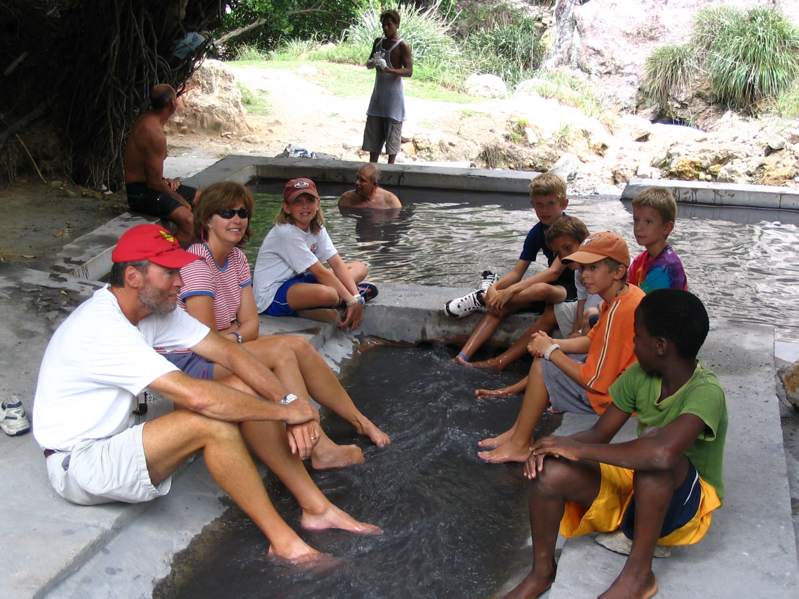
Although the standard of living in St. Lucia is less than the French countries, they seem to be trying hard to preserve the natural resources of the island.
After several more days in St. Lucia, we left again before sunrise for a long sail to Bequia, a small island about 9 miles south of St. Vincent. The weather was very squally with lots of rain showers. While sailing just north of St. Vincent, we saw many whale spouts. Humpback whales spend part of the winter in the southern Caribbean. (We sure did not want to hit one, because they are much bigger than the boat.) The island where we were headed, Bequia, was settled originally by whalers. They have a tradition of killing Humpback whales. Because of this tradition, the ICC grants Bequia the right to kill 4 Humpback whales each year between February and April. Just 2 days before we arrived they had killed their first whale this year (and, fortunately for the Humpback whales, the first one in several years). Everyone was talking about it. They are required to use traditional boats, which means 8 guys in a small wood boat with no motor and a harpoon thrown by hand. Once the whale is harpooned, it drags the 8 guys in the small wood boat around until it is exhausted.

They then drag the whale to shore where it is butchered and the meat sold to the islanders. Bequia also has a long sailing and boat building history. They build colorful, wood sailing boats on the beach that are used for fishing and whaling.
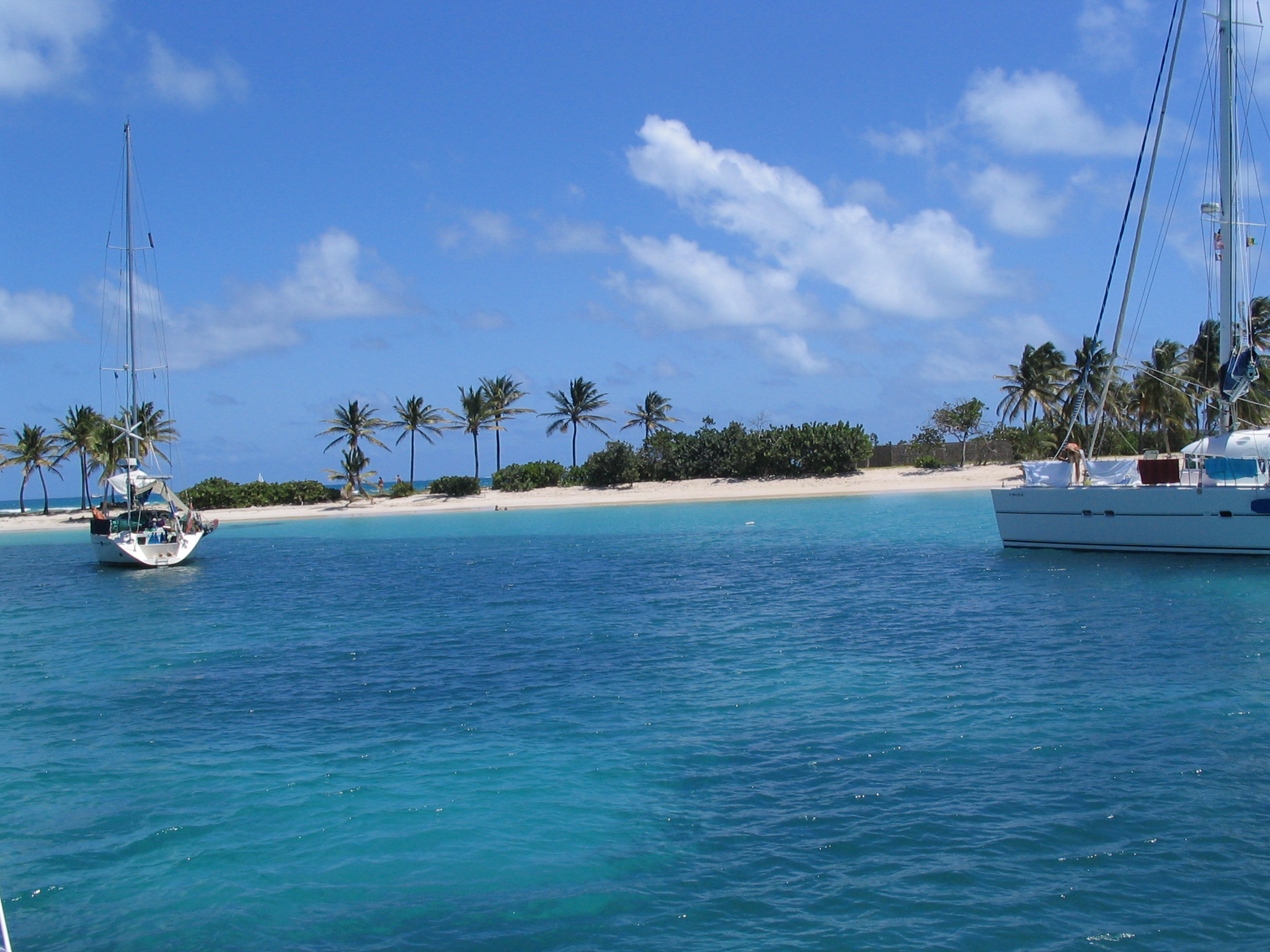
After a few days in Bequia, we headed south into the Grenadines with our irst stop in the Tobago Cays, an uninhabited group of small islands and reefs due east of Union Island and about 30 miles south of Bequia. They look like a combination of flats you would see in the Bahamas and small islands in the South Pacific. Large flats of white sand in less than 10 feet of water and beautiful white beaches.
Also, great snorkeling on a huge reef. While snorkeling, Cameron, Haley, and Travis have now identified over 50 different species of fish. Lots more to go. We have also seen lots of turtles, Hawksbills and Green turtles. The anchorage in the Tobago Cays is behind a reef in sand with nothing in front of you but thousands of miles of the Atlantic Ocean all the way to Africa. The waves pile up on the reef and the trade winds blow constantly from the east. A very pretty spot spot. 
Our next stop in the Grenadines was the island of Mayreau, a very small island with only 250 residents. A French estate owns the entire island except for 21 acres that was sold to the St. Vincent government for the town site. The town has no name, one road, a couple of cars, and just got electricity a couple of years ago. We ate dinner at a restaurant in the town, the Island Paradise. We were the only ones there. It was one of the better places we have eaten. We left there and sailed to Union Island next and anchored on the west side in Chatham Bay, a large uninhabited bay with great snorkeling. We will spend a few days here and then a week or so more in the Grenadines before starting north.